ESA and World Bank Sign an Agreement on Using Earth Observation Information

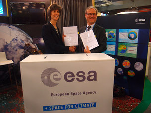
Signing the agreement
At the COP21 Climate Summit in Paris, the World Bank and ESA signed an agreement on using information from Earth observation satellites in support of sustainable development.
The World Bank, located in Washington DC, USA, is one of the world’s largest sources of development assistance. It provides financial support to projects especially in low and middle-income countries through loans and grants. This includes policy advice, research, analysis and technical assistance.
ESA’s partnership with the World Bank is anchored within the Bank’s Sustainable Development Cluster, which is the largest network of Global Practices in the World Bank. The collaboration started in 2008, with over 35 projects already carried out.
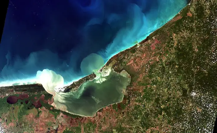
Earth observation has supported projects in disaster and risk management, climate change adaptation and urbanisation monitoring, as well as managing coastal and marine environment, water resources, agricultural commodities, forests and others.
“Earth observation is key to the sustainable development goals,” emphasised Laura Tuck, World Bank Vice President for Sustainable Development, at the signing of the Memorandum of Intent in Paris.
“A closer collaboration with ESA allows the Bank to strengthen the capacities of client countries in the use of Earth observation technologies and in setting directions as the Bank develops its strategic agenda for the use of geospatial information.
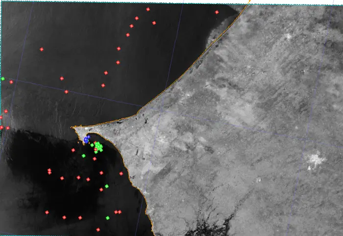
Fishing surveillance in West Africa. Credit: ESA
“The Bank recognises that Europe is a global leader in terms of space assets and capabilities, and is looking forward to working with ESA to expand the uses of this technology to meet global sustainable development challenges.”
Earth observation data help to manage and evaluate World Bank projects. By using Earth observation, organisations in developing countries will increase their technical capacities and will be able to collect a wide range of information from satellites. This will also strengthen their development plans and initiatives.
“This collaboration with the World Bank opens a new user community for the geospatial information our satellites are delivering from space,” says ESA’s Director of Earth Observation Programmes, Volker Liebig.
“It will also support the development of investment projects to boost prosperity and inclusive growth. This is an excellent initiative for ESA and the World Bank, but especially for ensuring sustainable growth in the future.”
This strategic partnership will lead to new opportunities throughout the development sector while using the satellite capabilities developed for better management of our planet’s resources.