European Space Imaging High-Res Urban Challenge & Win Imagery Worth EUR 20,000

The European Space Imaging High-Res Urban Challenge gives a sneak preview on this very high-resolution imagery (40 cm, 8-band) collected by European Space Imaging (EUSI) recently, the data corresponding to 305 Large Urban Zones (LUZ) represented in the 2006 edition of the Urban Atlas, a Copernicus land monitoring service. this high-res urban coverage will become available as part of the Copernicus Data Warehouse.
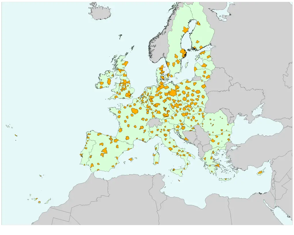
Map of Large Urban Zones (LUZ) covered by this very high-resolution data set indicated in yellow.
Credit: Copernicus Masters
The European Space Imaging High-Res Urban Challenge seeks solutions which extend the value of this data set in finding new applications to support decision makers in their manifold tasks, such as strategic planning, environmental monitoring, crisis management, change management, trend analysis, urban solutions, etc. The proposed ideas should be proven, automated and transferable across data sets.
About Urban Atlas
The Urban Atlas is a joint initiative of the European Commission Directorate-General for Regional Policy and the Directorate-General for Enterprise and Industry with the support of the European Space Agency and the European Environment Agency.
The Urban Atlas has a key designed to capture urban land use, including low density urban fabric, and a resolution that is 100 times higher than CORINE land cover. The Atlas brings cities and urban fringes into focus. The 2.5 meter resolution in combination with the street network allows for a wide range of additional analyses such as proximity to green space or train stations, and provides a far more accurate picture of urban sprawl in the fringe of urban zones.
Evaluation Criteria
- Benefit and innovativeness (customer benefit for industry/citizens, other advantages, innovation level)
- Copernicus relevance (significance of the use of Earth monitoring data for realisation, added value through Copernicus)
- Integration of 40 cm VHR satellite data and use of the 8 bands
- Proven solution that is transferrable across data sets and can be automated
- Market potential (chance of commercial success, such as expected demand, investment potential and short time to market)
- Legal aspects and risks (legal risks, ability to patent, regulations/laws to be considered)
Who is Eligible?
This challenge is open to residents of Europe and North Africa only.
Prize
The winner of European Space Imaging Challenge will be awarded a European Space Imaging (EUSI) data package of very high-resolution satellite data imagery worth up to EUR 20,000 for use in further developing the winning application.
Deadline for Registration: 13 July 2015
Register Now
Read more at http://goo.gl/HOYRWW