Leica Geosystems Releases ALS80 Next Generation LIDAR Mapping Solution with Market-Leading Productivity
The new Leica ALS80: smaller and lighter electronics, with laser completely integrated into scanner housing
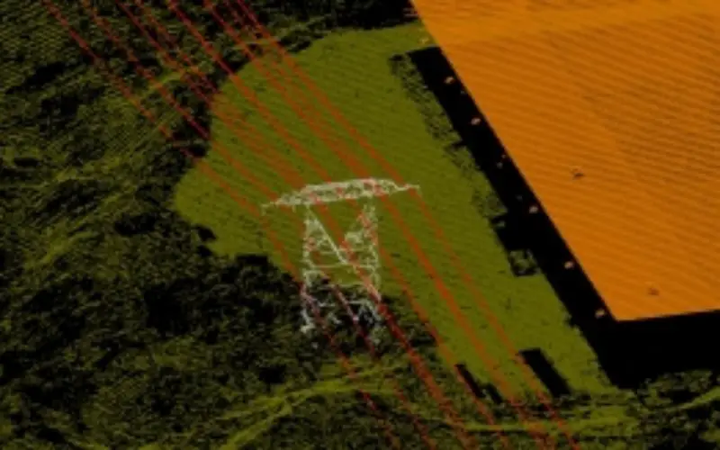
Leica Geosystems introduces its next generation of airborne LiDAR solutions, the Leica ALS80. By incorporating advanced laser technology, new high-speed point cloud generation and viewing software, faster acquisition and processing time and their related costs savings are now possible. Users benefit from the new Leica ALS80-CM and ALS80-HP systems’ expanded Multiple Pulse in Air (MPiA) capabilities and a new scanning geometry that offers industry-leading pulse rates up to 1.0 MHz. This technology greatly expands pulse rate capability throughout the entire range of flying heights, allowing faster collection rates and shorter flight times. For users operating in mountainous terrain, the Leica ALS80-HA offers significantly increased pulse rates during high-altitude operation.
“Users have responded positively to the simplicity of the ‘one laser, one scanner’ pioneering approach introduced by the Leica ALS70,” says Ron Roth, Vice President of Airborne LiDAR at Leica Geosystems’ Geospatial Solutions Division, “The Leica ALS80 continues to develop this approach, and builds on the successes of the Leica ALS70 by greatly expanding the operating envelope while, at the same time, improving in numerous other areas such as point spacing uniformity, range resolution, minimum pulse separation and packaging. The companion software Leica CloudPro and Leica AHAB LSS Viewer, give users a processing workflow that keeps up with the increased hardware productivity.”
Advanced laser and scanning optics 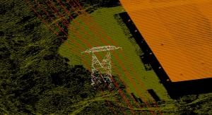
Not only does the Leica ALS80 incorporate an advanced laser design enabling ultra-high pulse rates, it also allows increases range resolution, offers higher peak power in each pulse and lower random noise, all of which improve the quality of delivered data. In addition, a refined scan geometry improves consistency in along-track point spacing and reduces flight times on jobs where variation in along-track point spacing is limited.
Accurate positioning – worldwide
In order to ensure the best signal in all geographic regions, the Leica ALS80 comes equipped with the NovAtel OEM638 GNSS/IMU subassembly, which provides users with a future-proof precision receiver solution that tracks signals of all available constellations, GPS, GLONASS, Galileo and BeiDou as well as L-band, SBAS and QZSS. The OEM638 also continues to support the popular CUS-6 IMU, providing the best possible orientation solution that maximises data accuracy.
Improved packaging
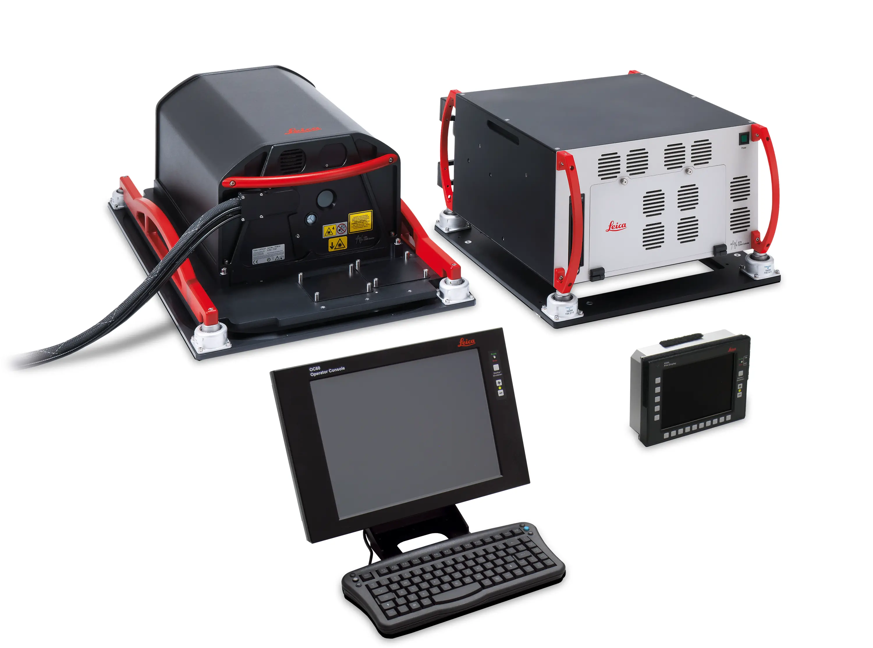
The Leica ALS80 eliminates any fixed cabling between system electronics and the scanner and makes installation in external pods even easier with the entire laser assembly now inside the scanner head. By using an advanced laser design, the ALS80 is able to reduce the size of the system’s electronics and eliminate 13 kg of electronic weight, without changing the size or weight of the scanner. The result is easier installation in all airborne platforms. In addition, the Leica ALS80 incorporates OC60 and PD60 operator and pilot displays, standardising the user interface across the entire Leica Geosystems airborne product array.
Processing software increases production rates
The Leica ALS80 will ship with two new software products to complete the new mapping solution, both of which improve processing throughput and reduce data delivery lead times. Leica CloudPro is the new multi-threaded point cloud generation software for the Leica ALS80, as well as earlier models. This software package features a multi-threaded design for processing speed that is up to six times faster and also provides a flexible projection engine that eliminates the need of third party software for projection changes. In addition, users can further streamline their processing by creating custom workflows using the built-in command-line interface, or call CloudPro directly from GeoCue job management software. All CloudPro customers will also receive free of charge the Leica AHAB LSS Viewer, a convenient point cloud viewing software that is easily deployed for field or in-house viewing of point cloud data without any additional software.
Availability
All variants of the Leica ALS80 will be available in selected regions starting in September 2014, and worldwide starting 2015. Ordering information and details are available from all authorised Leica Geosystems representatives. For owners of existing Leica ALS60 and Leica ALS70 systems, upgrades to the new Leica ALS80 configuration will be available starting in October, 2014.
The Leica ALS80 will be on display at INTERGEO 2014 in Berlin, from October 7- 9. Visit Leica Geosystems in Hall 1.1 Booth A1.024 !
Further information on the Leica ALS80 family of airborne LiDAR systems can be found at: http://www.leica-geosystems.com/als80