Maine Geological Survey Uses Real-Time Kinematic to Update Maine Beach Data
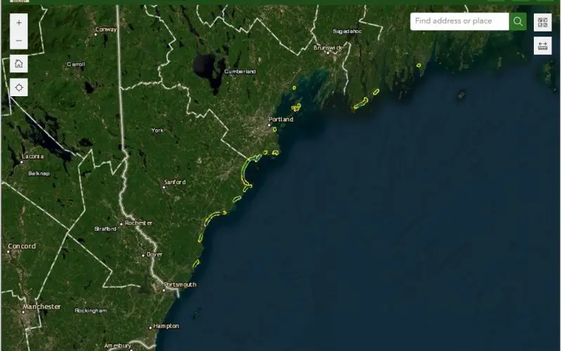
The Maine Geological Survey (MGS) has updated its Maine Beach Mapping (MBMAP) viewer with the latest data gathered during the summer of 2024. This update highlights critical changes to Maine’s coastline, offering valuable insights into beach erosion, dune movement, and overall coastal health. The MBMAP program, launched in 2005, has been instrumental in tracking the state’s beach and dune systems over time. In recent years, the program has focused on mapping the mean high-water contour to monitor beach width and coastal changes.
The 2024 data, collected by MGS coastal geology intern Jeannette Berman, covers 42 sandy beaches from Kittery to Bristol. This data includes information on changes in shoreline positions, dune shifts, and beach width, providing a detailed snapshot of Maine’s coastal landscape. The updated MBMAP viewer now allows the public to access this information, enhancing community awareness and conservation efforts.
Key Features of the Updated MBMAP Viewer:
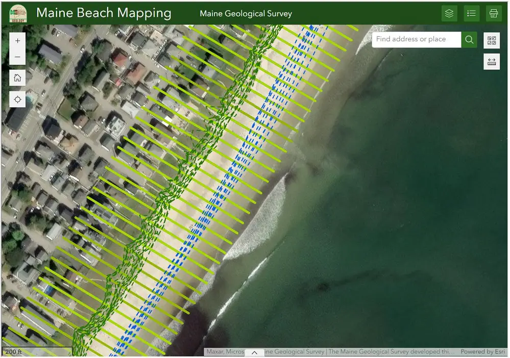
- Shoreline Positions: Users can view the natural shoreline, seawalls, and high-water lines, along with the precise dates and types of data collected.
- Dune Changes (2005-2024): The viewer highlights changes in dunes over time, showing recession and growth rates through color-coded transects. Between 2023 and 2024, monitored dunes receded by an average of 26 feet, with Popham Beach seeing a dramatic erosion of 124 feet.
- Beach Changes (2017-2024): The mean high-water contour, marking typical high tide, moved landward by an average of 14 feet from 2023 to 2024, with significant erosion noted at Reid State Park and Popham Beach. On the other hand, Western Beach in Scarborough experienced over 100 feet of growth due to a beach nourishment project.
- Mean Dry Beach Width (2017-2024): The average dry beach width in 2024 was recorded at 80.5 feet, with seawalled beaches measuring 49.9 feet and natural dune beaches at 85.4 feet. Despite minor decreases from 2023, some areas showed an average increase of 9 feet in dry beach width due to dune erosion providing more sand.
Role of Real-Time Kinematic (RTK) Technology
The precision and accuracy of the data collected are credited to the Real-Time Kinematic (RTK) global positioning system used by MGS. This technology allows for precise measurements of shoreline and dune positions with accuracy down to a few centimeters. RTK provides real-time corrections to satellite data, making it a powerful tool in tracking subtle shifts caused by erosion, sea level rise, and storms. This advanced method is essential in understanding the long-term impacts on Maine’s beaches.
For further analysis, the MBMAP viewer offers Beach Change Summary Statistics for both the previous year and overall beach changes, making this a critical tool for researchers, policymakers, and the general public alike. The data is also available for download in Geographic Information System (GIS) applications.
Source: Department of Agriculture, Conservation and Forestry, Maine Geological Survey