Increasingly, New Mexico’s key geospatial data needs must be met with high-quality, high-resolution, and current elevation data. Enhanced elevation data are essential to a broad and cross-cutting range of applications, analyses and evaluations, and established programs such as emergency preparedness, resource management, natural hazard response and mitigation, homeland security, and many others. Statewide lidar data will result in better elevation mapping.
The New Mexico Lidar Program, an activity of the New Mexico Geospatial Advisory Committee (GAC)‘s Elevation Data Planning and Acquisition Subcommittee, inventories and coordinates high-quality lidar projects for statewide lidar-data coverage. The Subcommittee also works with state and local government groups to engage New Mexico in joining with federal agencies to acquire statewide lidar data. To date, federal agencies largely have funded the state’s existing lidar projects (Santa Fe County funded most of its lidar acquisition).
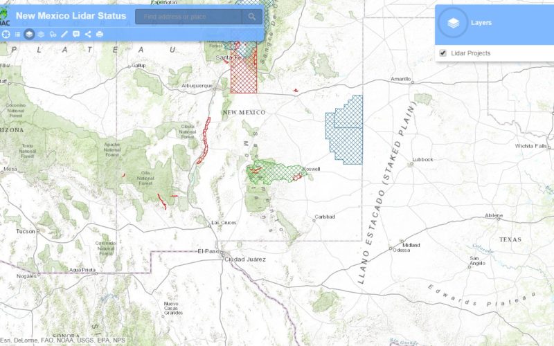
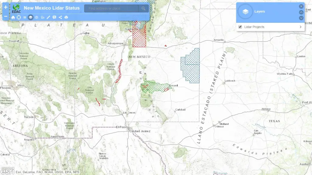
To view the current status of the lidar data availabililty, check out our New Mexico Lidar Status interactive map.
For more information about the New Mexico Lidar Program, please contact Subcommittee Chair Mike Inglis (minglis@edac.unm.edu) or Paul Neville (pneville@edac.unm.edu).
To request available lidar data, contact NM RGIS (clearinghouse@edac.unm.edu) or check out our RGIS Data Portal (http://rgis-data.unm.edu) to download data products.