The United Nations Development Programme (UNDP) has introduced the “Cambodia Poverty/Vulnerability Mapping Tool,” an innovative AI-powered platform designed to address socio-economic vulnerabilities across Cambodia. This tool represents a significant advancement in how data is utilized to combat poverty, providing insights and precision previously unattainable with traditional methods.
Overview of the Tool
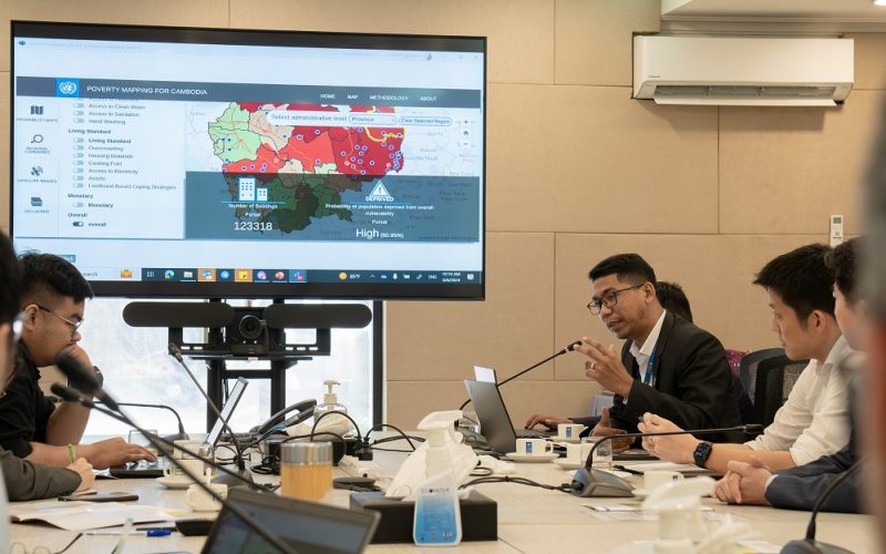
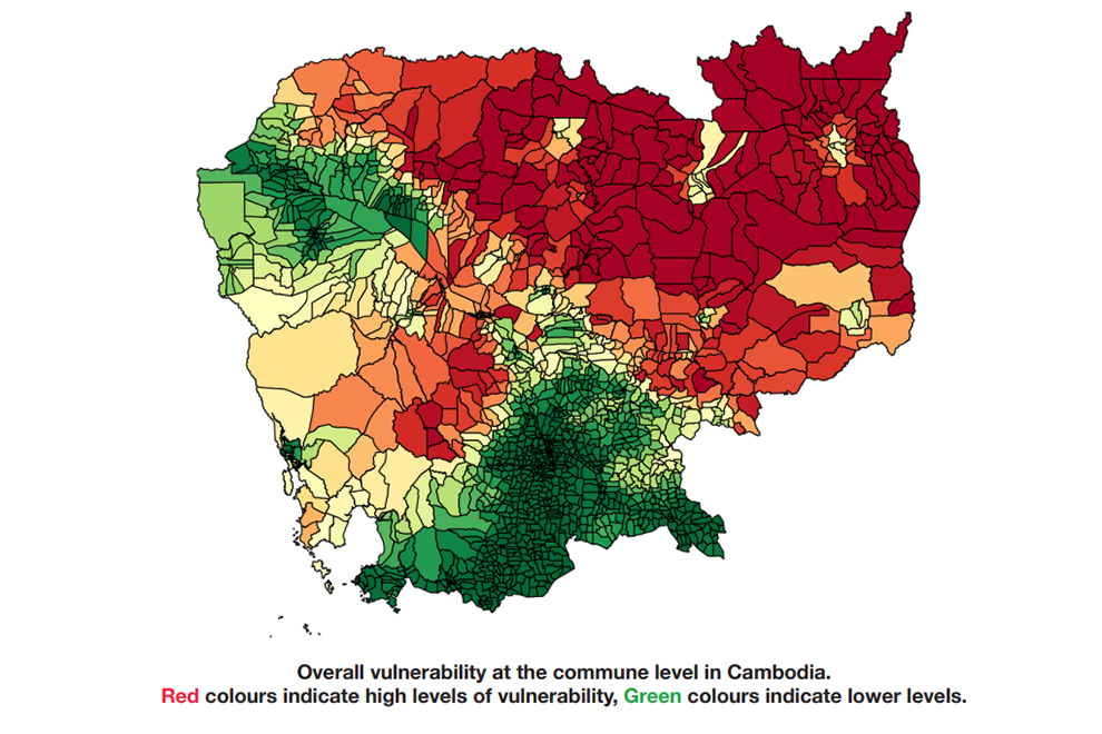
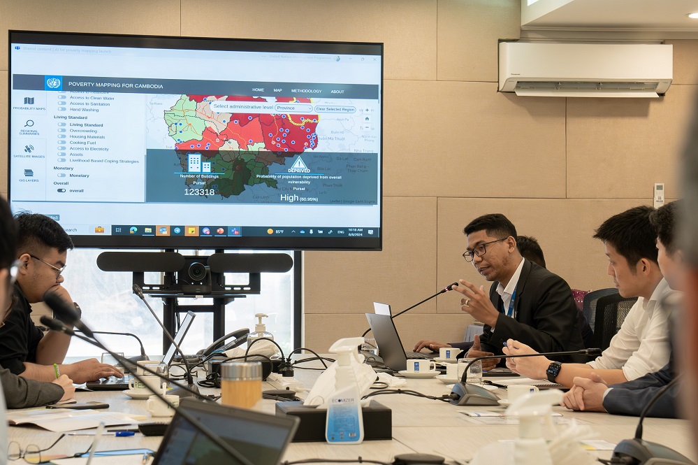
Launched on August 8, 2024, the Cambodia Poverty/Vulnerability Mapping Tool integrates advanced AI technologies, including machine learning and deep learning, to analyze a wide range of socio-economic indicators such as education, health, living standards, and income levels. The tool provides a colour-coded map illustrating vulnerability levels, with red indicating high vulnerability and green denoting low vulnerability.
One of the standout features of this tool is its real-time tracking capability, enabling the immediate identification of emerging vulnerabilities. This allows for swift responses from policymakers and aid organizations, ensuring that resources are directed where they are most needed.
Comprehensive Coverage and Real-Time Data
The tool covers all 25 provinces of Cambodia and can zoom in on the commune level, offering a detailed and localized view of socio-economic conditions (UNDP). This granular data is essential for understanding the specific challenges faced by different communities across the country, enabling dynamic and responsive policy-making.
Similar Read – World’s Biggest Aerial LiDAR Survey to Reveal Angkor Wat Historical Secrets
The Need for the AI-Powered Mapping Tool
Cambodia has long struggled with persistent poverty, particularly in rural and remote regions. Traditional data collection methods often fail to capture the overlapping and interrelated deprivations that contribute to poverty. This tool addresses this gap by integrating diverse datasets, enabling a more comprehensive analysis of socio-economic vulnerabilities.
The introduction of this tool comes at a crucial time, as Cambodia continues its efforts to meet the Sustainable Development Goals (SDGs). By providing policymakers with a more accurate picture of the challenges at hand, the tool is expected to significantly enhance the effectiveness of poverty reduction initiatives.
Impact on Policy and Planning
The Cambodia Poverty/Vulnerability Mapping Tool is a powerful instrument for policy-making, offering a multidimensional view of poverty and vulnerability. It helps reveal patterns and interactions that traditional analyses might miss, providing policymakers with the detailed information they need to develop targeted interventions.
The tool’s launch was discussed extensively by policymakers, data scientists, and development practitioners, who emphasized its potential to revolutionize planning and budgeting processes in Cambodia. By providing precise, localized data, ensures that interventions are tailored to the specific needs of different communities.
Conclusion
The launch of the Cambodia Poverty/Vulnerability Mapping Tool marks a significant advancement in Cambodia’s efforts to eradicate poverty. By leveraging AI and big data, the tool provides a comprehensive and real-time understanding of socio-economic vulnerabilities, enabling more effective and targeted interventions. As Cambodia continues its work towards the Sustainable Development Goals, this tool will undoubtedly play a crucial role in ensuring that no one is left behind.