NIO Launches GIS-Based Study to Reassess Goa’s Beach-Carrying Capacity
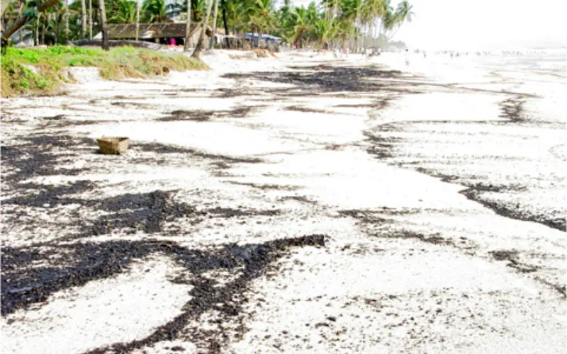
The National Institute of Oceanography (NIO) has initiated a comprehensive Geographic Information System (GIS)-based study to reassess the beach-carrying capacity along Goa’s coastline. This beach-carrying capacity evaluation aims to determine sustainable tourism activity levels, ensuring the preservation of the state’s coastal ecosystems. By focusing on beach-carrying capacity, the study will guide the optimal number and placement of beach shacks and other temporary structures.
Commissioned by the Goa Coastal Zone Management Authority (GCZMA), this 18-month project marks the first such assessment since 2017. The previous study, conducted by the National Centre for Sustainable Coastal Management (NCSCM), recommended that only 33% of beach areas be allocated for shacks, excluding ecologically sensitive zones, river mouths, creeks, fishing spaces, and buffer zones. Despite these guidelines, the number of operational shacks has averaged around 360, significantly lower than the 1,131 permitted at the time.
Also Read – Goa Launches “One Map Goa GIS” Portal for Smart Governance and Tourism
The current study will encompass the entire coastal stretch, including no-development zones as per the Coastal Zone Management Plan (CZMP) 2019, and areas up to 500 meters inland where development is permitted with prior approval. NIO’s analysis will consider factors such as climate change impacts, coastal erosion, and future beach space availability. The goal is to identify and geo-position optimal numbers of shacks that can be sustainably permitted along the coast.
NCSCM had recommended that only 33 per cent of the beach area can be made available for the erection of shacks after deducting the ecologically sensitive areas, river mouths, creeks, fishing space, and buffer areas at entry points. The agency had advised the government to revise the carrying capacity study after five years
Furthermore, the study will align with the State government’s recommendations to allow temporary structures in no-development zones, except in eco-sensitive areas identified in the CZMP 2011 and CRZ 2019 notifications. The GCZMA plans to adopt guiding principles set by NCSCM for determining the carrying capacity of shacks, huts, cottages, and tents on privately surveyed plots.
This initiative underscores the importance of balancing tourism development with environmental conservation. By reassessing the beach-carrying capacity, Goa aims to implement data-driven policies that support sustainable tourism while protecting its coastal heritage for future generations.
Source: The Goan