 “After support for Mobile Mapping and UAS Mapping content, we now proudly announce the support for Oblique Imagery and Aerial Point Clouds. From now on, anyone owning Oblique data can upload this data and share in seconds.”, says Peter Bonne, CEO of Orbit GT. “Furthermore, Oblique content can be immediately fused with Mobile and UAS Mapping content, on the fly. Gone are IT challenges, server installations or website building – it’s right there, out of the box.”
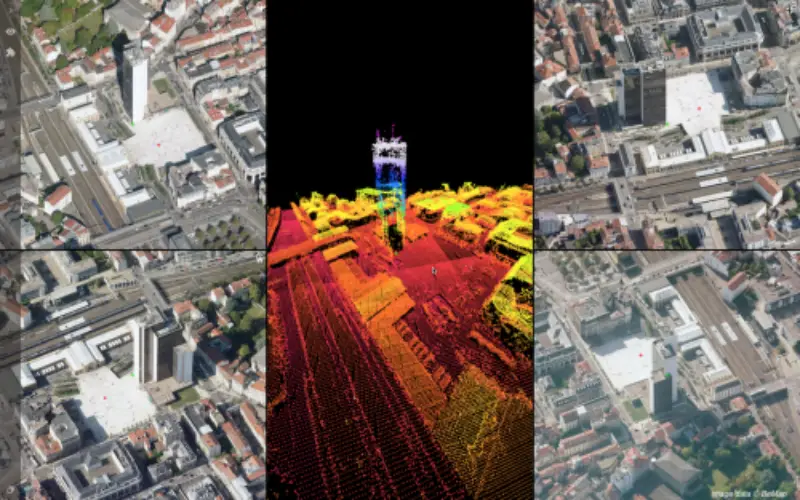
An Oblique Aerial project can include a point cloud, either dense matched or LiDAR, and a DEM grid. Oblique data is immediately supported by pre-existing functionality, such as measurements and sharing of resources. The Viewer system supports 4 viewing directions and a centrally placed 2D/3D reference map. Navigation is both easy and intuitive. Upload and proper preparation of the data is performed using the newly released Orbit Oblique Feature Extraction desktop software, available from www.orbitgt.com.
Join now on www.3dmapping.cloud. You must be a registered user to access the upload and sharing capabilities.