
Tag "Aerial Photogrammetry"
Col-East Taps Extensive Image Archive to Create Multi-Function Maps
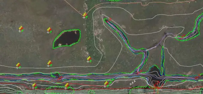
NORTH ADAMS, Massachusetts, 4 October 2017 – Col-East International Ltd., a provider of aerial photogrammetric services in the Northeast U.S. since 1952, tapped into its extensive archive of aerial imagery
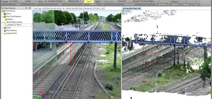
Trimble Business Center v3.90 Now Available
Trimble Business Center provides users with the capability to efficiently edit, process, and adjust geospatial data and create deliverables with confidence. The New features/updates included in TBC v3.90: Create, edit,
Georeferenced Video, an Alternative to Aerial Photogrammetry
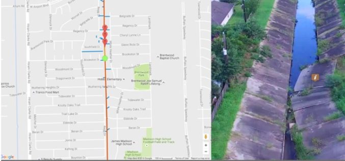
Contributed By:- According to the Texas Comptroller, the state of Texas spends nearly $6 million per year on public infrastructure, including highways and other repairs and maintenance activities. Local spending
TBC Power Hour – UAS Processing using new TBC/UASMaster Workflows
TBC Power Hour Webinar: UAS Processing using new TBC/UASMaster Workflows Dec 21, 2016 | 8 AM MDT or 4 AM MDT UAS (Unmanned Aerial Systems) are becoming part of daily
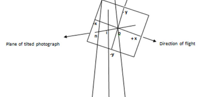
Basics of Photogrammetry
What is Photogrammetry? The classical definition of Photogrammetry is the process of deriving metric information about an object through measurement made on the photograph of the object. Photogrammetry is the
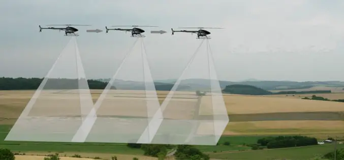
Basic Photogrammetry
The classical definition of Photogrammetry is the process of deriving metric information about an object through measurement made on the photograph of the object. Photogrammetry is the science of making
