
Tag "Arctic DEM"
GIS
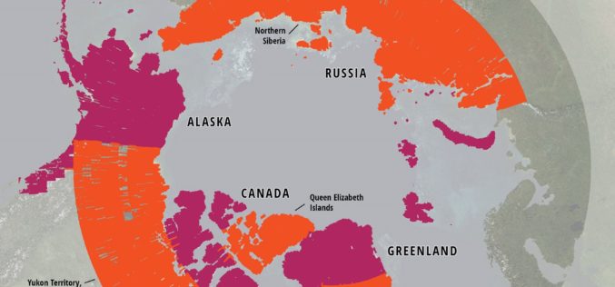
ArcticDEM Project Has Now Mapped More Than 65 Percent of The Arctic
ArcticDEM Release 5 represents the largest release of elevation data to date, more than doubling the number of available strip DEMs, mosaic tiles and geographic coverage area of all releases
Business
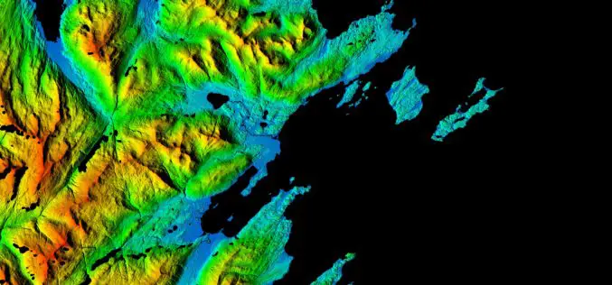
NGA, NSF release 3-D Elevation Models of Alaska for White House Arctic Initiative
SPRINGFIELD, Va. — The National Geospatial-Intelligence Agency and the National Science Foundation publicly released new 3-D topographic maps of Alaska Sept. 1 in support of a White House Arctic initiative
