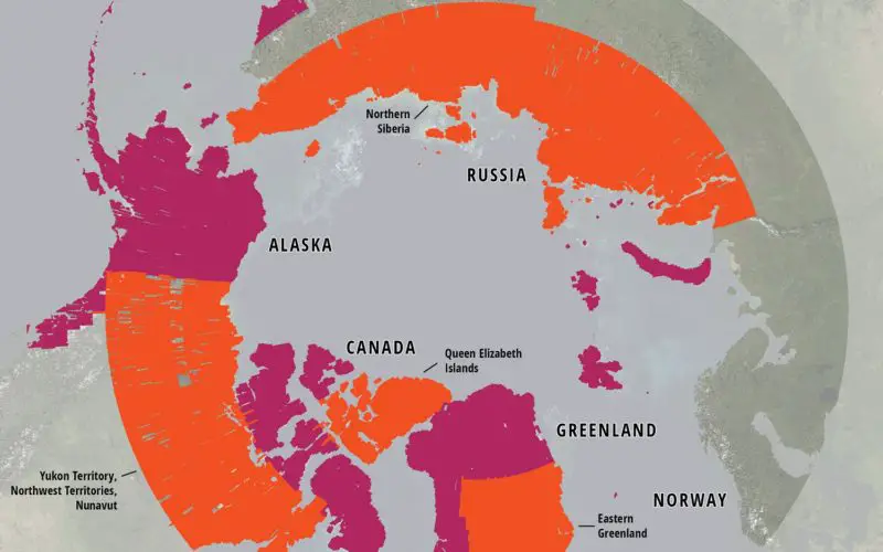
ArcticDEM Release 5 represents the largest release of elevation data to date, more than doubling the number of available strip DEMs, mosaic tiles and geographic coverage area of all releases thus far combined.
SPRINGFIELD, Va. — The National Geospatial-Intelligence Agency, in collaboration with the National Science Foundation’s Polar Geospatial Center and Esri, has mapped more than 65 percent of the Arctic, detailed in the fifth Arctic DEM project release June 2.
The 3-D digital elevation models, or DEMs, are the first to come from the ArcticDEM project, which was created after a January 2015 executive order calling for enhanced coordination of national efforts in the Arctic.
This release is the largest yet, mapping 7.5 million square kilometers of the Arctic. With the previous four DEM releases, more than 24.6 million square kilometers of the Arctic has been mapped.
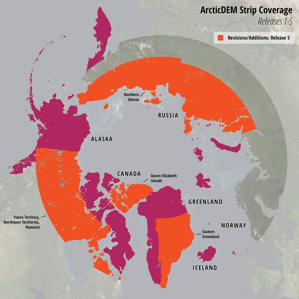
Graphic from The Polar Geospatial Center.
ArcticDEM Release 5 represents the largest release of elevation data to date, more than doubling the number of available strip DEMs, mosaic tiles, and geographic coverage area of all releases thus far combined. Additions to the ArcticDEM inventory include the Yukon Territory, Northwest Territories, and remaining Nunavut regions of Canada; the remaining central and southeastern regions of Greenland; and a significant portion of Russian Siberia north of 65° N and 66° N latitude.
Release 5 adds 33,169 strip DEM components at 2 meter resolution to the ArcticDEM inventory, with an additional 3,799 mosaic tiles at 5 meter resolution.
The project estimates total coverage of the Arctic landmass by December.
Upon completion, ArcticDEM will encompass all land area north of 60° north latitude. In addition, coverage will include all territory of Greenland, the State of Alaska in entirety, and the Kamchatka Peninsula of the Russian Federation. The project commences with Alaska and will continue to other regions in the Arctic on a continual basis.
There have been 300,000 online downloads since the DEMs became publicly available in February.
For more information visit the NGA Arctic website.