
Tag "Flood risk mapping"
GIS
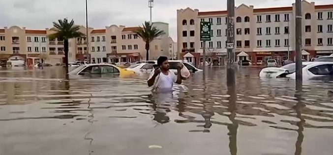
Oman Begins Comprehensive Flood Risk Mapping to Enhance Safety
Oman is initiating a major project focused on Flood Risk Mapping across the country. The Ministry of Agriculture, Fisheries, and Water Resources has engaged a specialized company to lead this
GIS
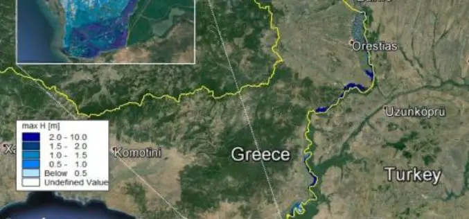
Conducting Flood Hazard and Risk Mapping For the Complex Evros River Basin
Z&A P. Antonaropoulos & Associates S.A. designed flood hazard and flood risk maps for the Greek part of the Evros River Basin after completing our MIKE FLOOD training course. The
LiDAR
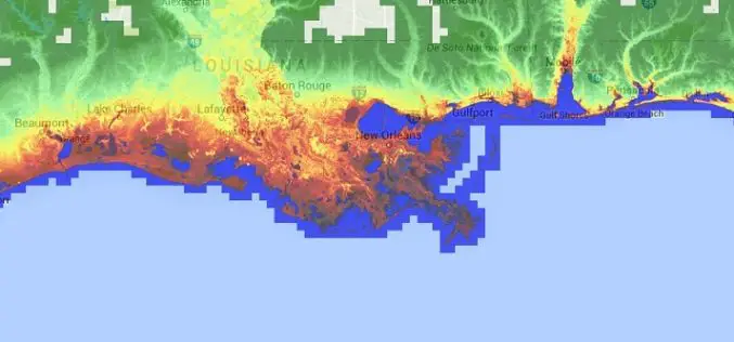
Accuracy Comparison of Publicly available DEMs and LiDAR DEM for Coastal Flood Risk Assessments
Coasts are experiencing the adverse consequences of hazards related to climate change and sea level rise and will be exposed to increasing risks of coastal flooding. Ten percent of the
