
Tag "GIS software"
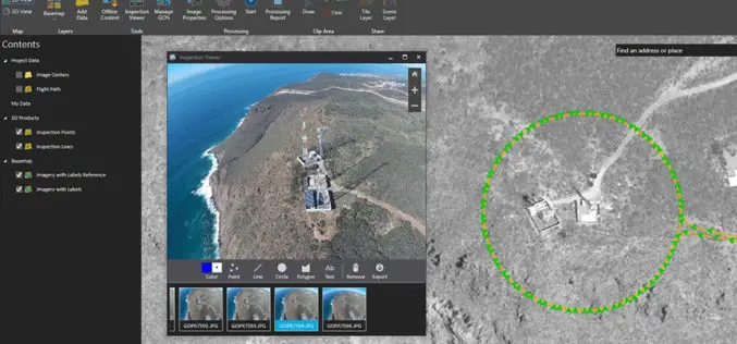
Esri Announces the Release of Drone2Map for ArcGIS
Drone2Map for ArcGIS is Now Available Esri is pleased to announce the release of Drone2Map for ArcGIS, our new desktop app that allows you to turn drone-captured still imagery into

Icaros Releases 4.2.2 of OneButton UAS Image Processing Software
FAIRFAX, Virginia, USA – Icaros Inc., a leading provider of aerial imaging software, is pleased to announce Release 4.2.2 of OneButton. The release contains new features and improvements as well as
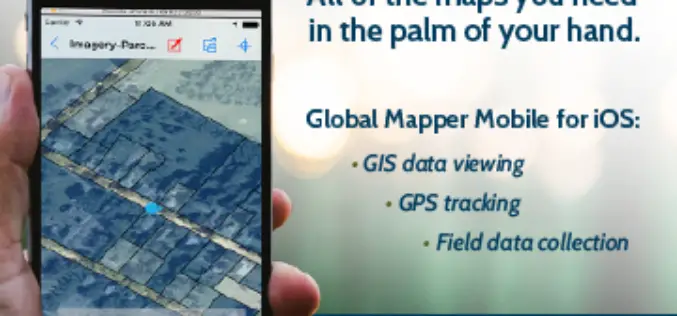
Global Mapper Mobile is Now Available for iOS
Blue Marble Geographics are pleased to announce the immediate availability of Global Mapper Mobile for iOS, a field-optimized version of the desktop software. Global Mapper Mobile offers powerful GIS data

Build Smart 3D Cities in Minutes with Game-Changing Esri CityEngine 2016
Redlands, California—Esri, the global leader in geographic information system (GIS) solutions, today announced the release of Esri CityEngine 2016. This revolutionary modeling technology allows GIS professionals, 3D artists, architects, and

Topcon and Bentley Systems Announce Integration between Magnet 4.0 and Project wise
Creating bi-directional design through construction workflows LIVERMORE, Calif., USA/ CAPELLE A/D IJSSEL, The Netherlands, and EXTON, Pa., USA – June 2, 2016 – Topcon Positioning Group and Bentley Systems announce
Coming Up Next: SuperGIS Server 3.3
The new GIS server from Supergeo, SuperGIS Server 3.3, is a product designed to meet the modern technologies in client side applications. One of the major upgrades will focused on

Upgrade Your Work Efficiency by GIS Complete Solution of Supergeo
The product team of Supergeo is continually striving to develop various GIS software to pursue the latest trend in the geospatial industry. Corresponding to the advancement of hardware and various
Global Mapper 17.2 Released with New Map Book Creation Tool and Cutaway Terrain View
Hallowell, Maine – May 17, 2016 – Blue Marble Geographics (bluemarblegeo.com) is pleased to announce the immediate availability of Global Mapper version 17.2. This upgrade to the version 17 release

The Whole New Update of Leading Mobile GIS—SuperPad 3.3
It is our great pleasure to announce a new version of SuperPad had just been released. After hundred hours of hard work, some advanced development was accomplished, and now it
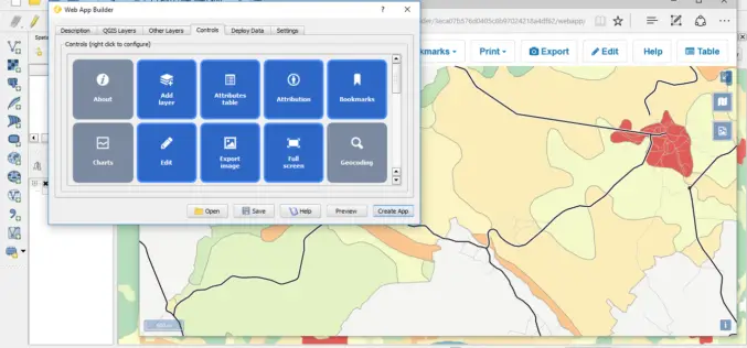
QGIS 2.14.1 Now Available from Boundless!
Boundless QGIS 2.14.1 is out the door! We are excited to share with your the latest offering of premier open-source desktop GIS technology. This release is available here and is

