
Tag "Groundwater"
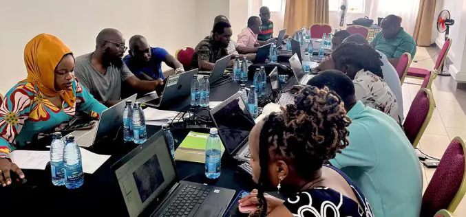
USGS Uses Remote Sensing for Groundwater Mapping in Kenya
Groundwater mapping in Kenya has received a major boost through the use of remote sensing technologies, spearheaded by the U.S. Geological Survey (USGS), USAID, and Northern Arizona University. Remote sensing
Seequent Accelerates Cloud-Based Solution to Help Keep World at Work on Major Projects
High-growth geoscience software company Seequent is accelerating the development of its cloud-based solution Seequent Central, enabling organisations to continue work on critical, large-scale, earth, environment and renewable energy projects in
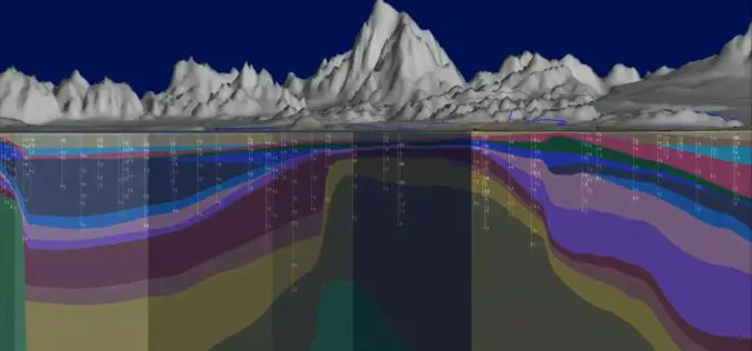
SwRI Investigates New Techniques To Estimate Groundwater Recharge
August 22, 2018 — Southwest Research Institute scientists are investigating using the latest remote-sensing technology to assess groundwater recharge more accurately. This information is critical for water resource managers, especially
NAU Scientist Uses Remote Sensing to Detect Groundwater in Drought-stricken East Africa
Drought is a condition when a region notes a deficiency in its water supply whether surface or underground water. A drought can last for months or years, or may be declared
Pilot Project on Aquifer Mapping In Five States
According to recent news, the Government of India has undertaken a pilot project on aquifer mapping in parts of five states. Union Minister of State for Water Resources Sanwar Lal
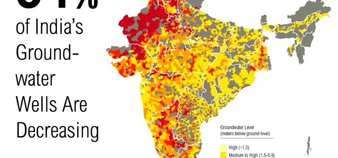
Government to Expedite the Task of Groundwater Mapping
New Delhi – The Government of India has decided to speed up the task of mapping of aquifers for better management of groundwater. Mapping of underground water source is expected to
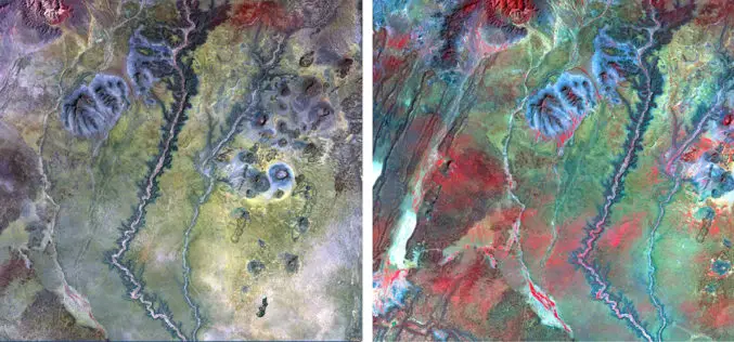
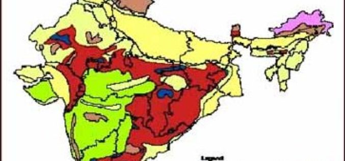
Identification of Artificial Recharge Sites Using Remote Sensing Technology
Identification of Artificial Recharge Sites Using Remote Sensing Technology Groundwater is a major source for all purposes of water requirements in India. More than 90% of rural and nearly 30%
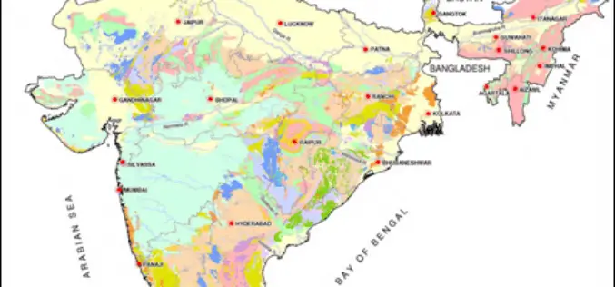
3D Mapping of Groundwater Resources of India
In recent news by Deccan Chronicle, National Geophysical Research Institute (NGRI) is planning to take up a massive a groundwater mapping programme across the entire landmass of India using advanced
