
Archive

Aerial LiDAR Survey to Produce 3D Flood and Hazard Maps for River System in Philippines
Catandunganon, Philippines – Recently a team from the Department of Science and Technology (DOST) and the University of the Philippines Training Center for Applied Geodesy and Photogrammetry (UP TCAGP) has conducted
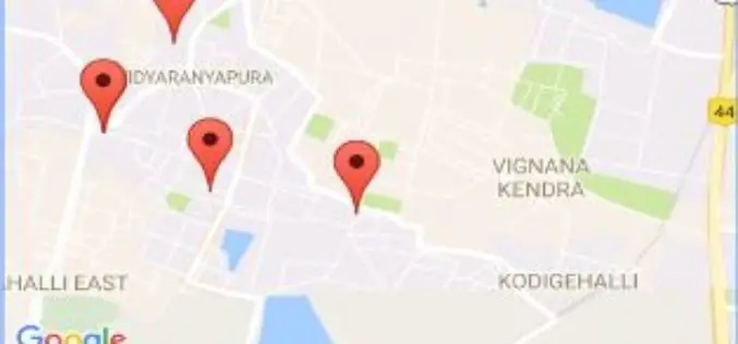
Karnataka State Health Department Launches GIS App to Help Accident Victims
Bengaluru – According to recent news reported by The New Indian Express, Karnataka State the Health Department has unveil an app called Nearby Services. The app is launched under the
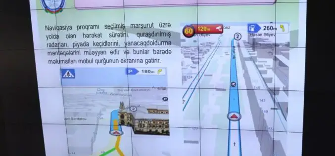
Azerbaijan Launches First National Navigation System – AzNav
According to recent news reported by the AZERNEWS, Azerbaijan has recently launched its first national navigation system “AzNav” by the Center for Information Technology and Information Management of the State Committee on
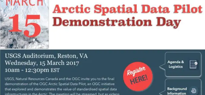
OGC Invites You to the Arctic Spatial Data Pilot Demonstration
23 February 2017: The Open Geospatial Consortium (OGC®) invites members and the public to attend the OGC Arctic Spatial Data Pilot demonstration online or in-person on the 15th March 2017

World View and Ball Aerospace Demonstrate Persistent Remote Sensing from Stratollite Platform
Successful Proof of Concept Test for Commercial Use Tucson, Ariz., Feb. 23, 2017 – World View and Ball Aerospace successfully completed a Stratollite mission earlier this month, demonstrating early capabilities

In Defense of Desktop: Why Desktop is Essential for Drone Mapping in Agriculture
Part 1: How quickly can you go from landing to processing? If you want an NDVI map while you’re still in the field, cut out a potentially long upload to

Drones in Agriculture and Hands-On Drone-to-GIS Workflows
Hands-On Drone-to-GIS Workflows Sponsored by the Michigan State University Institute of Agricultural Technology, in coordination with RS&GIS and Northwest Michigan College. This unique and comprehensive, instructor-led training course is taught

Smart City Projects Should Talk About Solutions to Natural Calamities
According to recent news by the Moneycontrol, The Earth Sciences Ministry’s ex-secretary Shailesh Nayak, has said that at a time when earthquakes happen frequently and temperatures are reaching extremes, the government’s
EuroGeographics Enhances Open Data for 2017
February 22, 2017 – Users of EuroGeographics pan-European open data will benefit from a series of enhancements to the latest release of EuroGlobalMap. Forty-five members of the Association for the
Global Mapper 18.1 Now Available with Improved 3D Viewing, New Fly-Through Visualization Options, and LIDAR QC Tools
Blue Marble Geographics is pleased to announce the immediate availability of Global Mapper version 18.1. This complimentary upgrade to the version 18 release includes numerous functional enhancements throughout many areas
