
 In recent news by Deccan Chronicle, National Geophysical Research Institute (NGRI) is planning to take up a massive a groundwater mapping programme across the entire landmass of India using advanced helicopter surveys.
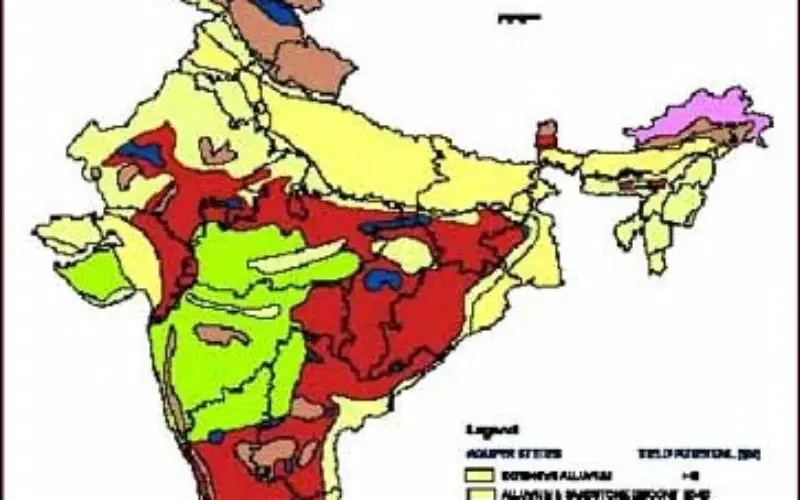
Aquifer mapping will help prepare a 3D map of groundwater resources at every point across the country and hence help in their efficient usage and sustainability.
In collaboration with Aarhus University in Denmark, NGRI had taken up pilot projects in five states (Tamil Nadu, Rajasthan, Bihar, Uttar Pradesh and Maharashtra) of India for aquifer mapping two years ago.
Most countries in the world are now using continuous aquifer mapping to ascertain their groundwater resources and use them judiciously. These surveys can even find points and sources of contamination in groundwater.
The institute has put the proposal on the desk of Union Ministry of Water Resources and is waiting for a green signal. The mega project could span up to a decade and cost Rs 8,000 to Rs 10,000 crore.
Dr Shakeel Ahmed, chief scientist and team leader, Indo French Centre for Groundwater Research (IFCGR), NGRI, said the outcome of the pilot project was extremely satisfactory.
“The pilot project results were very good. We could very accurately map aquifers of the pilot sites that were selected. We have now submitted a proposal to the Centre to scale up the project to the whole country,” Dr Ahmed said. NGRI has brought in European technology, which uses helicopter-borne Transient Electro-magnetic surveys over the ground to prepare 3D maps.
“Scientists could 3D map profiles of the ground up to 200 metres in hard rock areas and 300 metres in alluvial soil areas. One of the 3D maps in Bihar showed the merging of two aquifers, one of which was contaminated with Arsenic while water in the other was pure”.


Just wanted to know if similar studies cannot be done using satellite mounted water resource detecting technologies rather than depending on helicopter mounted studies,as proposed here above.
Pl excuse me for my limited knowledge on these techniques.
The system for mapping groundwater resources need a giant hexagon-shaped frame fitted with electromagnetics, a global positioning system, lasers, loggers, and a computer strapped. The system creates precise records by shooting rapid-fire electromagnetic waves, similar to radio signals, into the ground every 9 feet — to a depth of 900 feet — all the way to bedrock
These facilities can not be attached with a satellite. Moreover helicopters can fly back and forth across parts much master than satellites (high temporal resolution).