
Tag "Hyperspectral"

Call for Proposals for Geospatial Technology and Solutions: Impact and Importance for India’s Future
The National Geospatial Programme (NGP) division, formerly NRDMS, calls for proposals in Geospatial Technology and Solutions that have the potential to impact various sectors in India significantly. The National Geospatial
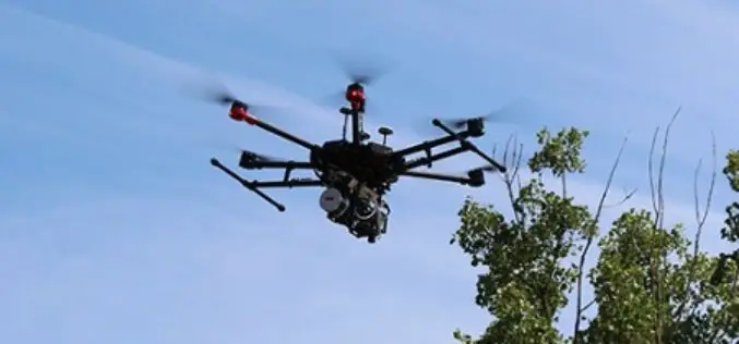
Headwall Integrates Hyperspectral and LiDAR Aboard UAV Platforms
Enabling Remote Sensing Capabilities From Civil Infrastructure Inspection to Crop Monitoring BOLTON, MA, JUNE 11 – Headwall has introduced advanced sensor payloads consisting of hyperspectral sensors and LIDAR for deployment
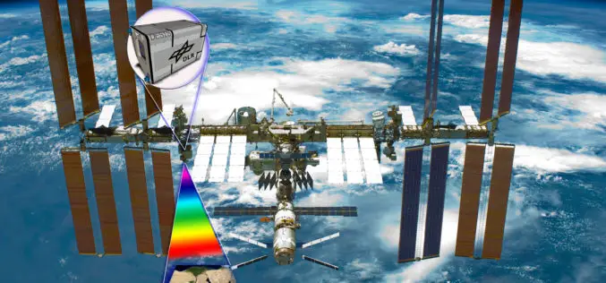
Hyperspectral Instrument DESIS En Route to International Space Station in 2018
The DLR Earth Sensing Imaging Spectrometer (DESIS) environment and resource monitoring system will launch to the ISS in the summer of 2018 The hyperspectral sensor system has a spatial resolution

Learn SNAP Using EU Flagship Copernicus Satellite Program
Geo University has come up with a video course that provides a detailed walkthrough guide of the European Space Agency (ESA) Sentinels Application Platform (SNAP) software. A common architecture for all Sentinel Toolboxes is

ImageSat International and Ben-Gurion University to Collaborate on Miniature Hyperspectral Imaging System
Technology based on university research could lead to new generation of spectral systems for flight and space-based remote sensing BEER-SHEVA, Israel…December 27, 2016 – ImageSat International (ISI) and Ben-Gurion University

PhD Position: Methodological, Algorithm and Processing Chain Development for Analysis of Hyperspectral Image Data
The institute section “Land Surface” deals with the development of remote sensing methods based on various earth observation systems that are specifically adapted for the respective application scenarios. Key issues

World Campus Remote Sensing Certificate Helps GIS Professionals Use Drone Data
UNIVERSITY PARK, Pa. — Drones are suddenly everywhere — gathering crop data, monitoring air pollution, helping with search-and-rescue missions and even taking “drone selfies.” But the increase of data collection

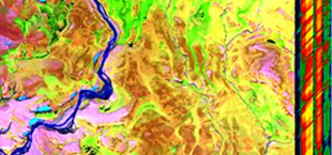
Hyperspectral Narrowband and Multispectral Broadband Indices for Remote Sensing of Crop Evapotranspiration and its Components
Hyperspectral narrowband and multispectral broadband indices for remote sensing of crop evapotranspiration and its components (transpiration and soil evaporation) By: Michael T. Marshall, Prasad S. Thenkabail, Trent Biggs, and Kirk Post
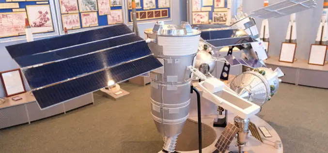
Russian Space Systems to Launch Resurs-P No. 3 Remote Sensing Satellite
MOSCOW- According to recent news by the Sputnik, Russian Space Systems company said that launch of Russia’s Resurs-P No. 3 remote sensing satellite has been scheduled for March 12. The Resurs-P
Global Hyperspectral Remote Sensing Market 2015 Industry Trends, Analysis and Forecast to 2019
Global Hyperspectral Remote Sensing Industry 2015 and analysis by 2019 analyzed the world’s main region market size, share,trends,conditions, including the product price, profit, capacity, production, capacity utilization, supply, demand and
