
Tag "JAXA"
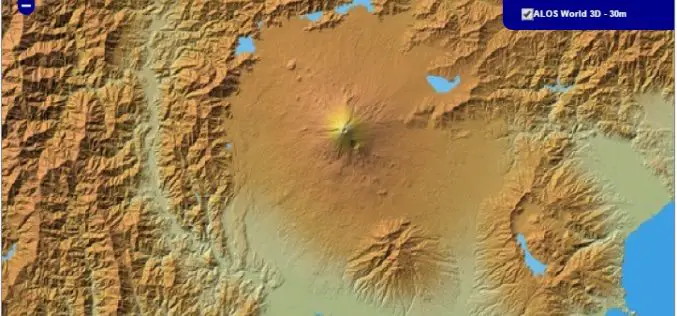
30 meter World Elevation Data is Now Available at JAXA’s Site Free of Charge!
The Japan Aerospace Exploration Agency (JAXA) will begin publishing free of charge an elevation data set that can express undulations of terrain over the world with a resolution of 30

Information Boucher on Global Precipitation Measurement (GPM) Core Observatory
The Global Precipitation Measurement (GPM) mission is an international partnership co-led by NASA and the Japan Aerospace Exploration Agency (JAXA). The mission centers on the deployment of the GPM Core
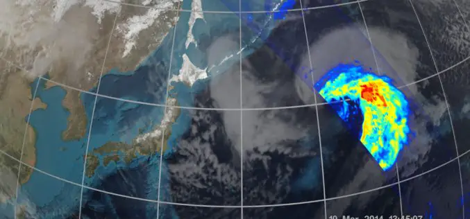
NASA | GPM’s Stormy New View
The GPM Core Observatory was the first of five planned Earth science launches for the agency in 2014. The joint NASA/JAXA mission will study rain and snow around the world,
First Images Available from NASA-JAXA Global Rain and Snowfall Satellite
NASA and the Japan Aerospace Exploration Agency (JAXA) have released the first images captured by their newest Earth-observing satellite, the Global Precipitation Measurement (GPM) Core Observatory, which launched into space
