
Tag "Leica HxMap"
Business
Airborne LiDAR Production Now Fully Integrated With Leica HxMap Workflow
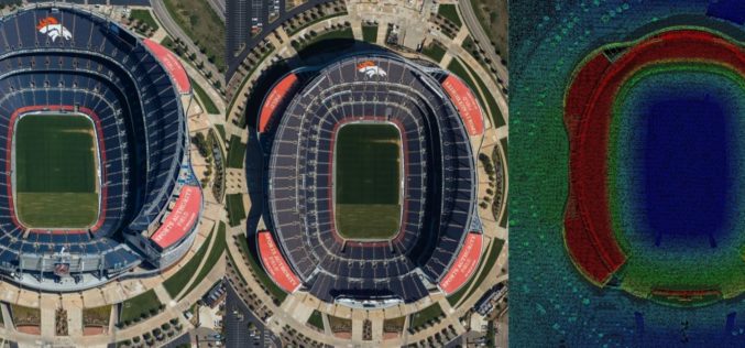
Leica Geosystems, industry leader for reality capture and measurement technology, announced today the release of LiDAR data processing capability in the Leica RealCity solution package. Leica Geosystems partnered with international asset
Business
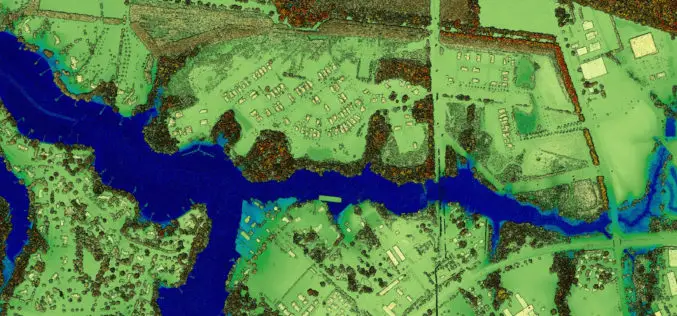
New Leica SPL100 Brings up to 10x More Efficiency to Airborne LiDAR
Latest Single Photon LiDAR technology collects 6 million points per second (Heerbrugg, Switzerland, 13 February 2017) – Leica Geosystems, industry leader of reality capture and measurement technology, announced today the
