
Tag "LiDAR point cloud"

Business
Sanborn Announces Launch of GeoServe LiDAR Viewer and QC Interface
Online LiDAR Viewer Will Streamline Client QC Processes, Ensure Quality Results, and Expedite Project Delivery COLORADO SPRINGS, Colo., Feb. 14, 2017 /PRNewswire/ — The Sanborn Map Company, Inc. (Sanborn) announces
GIS
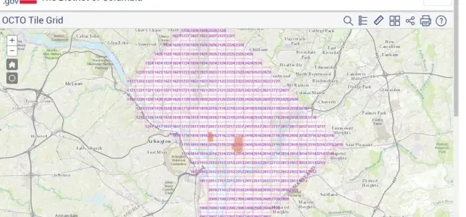
Classified LiDAR Point Cloud of Columbia Available on Amazon S3
According to recent updates on Amazon AWS, LiDAR point cloud data for Washington, DC is available for anyone to use on Amazon S3. The dataset, managed by the Office of the Chief

Software
LizardTech Launches GeoExpress 9.5
LizardTech, a provider of software solutions for managing and distributing geospatial content, announced the launch of GeoExpress 9.5 at this week’s Esri International User Conference, California. GeoExpress enables geospatial professionals to
