
Tag "LiDAR"
Orbit GT Releases 3D Mapping Content Manager V18
Jan. 30, 2018 – Orbit GT is happy to release the new 3D Mapping Content Manager v18. “The Content Manager is arguably the most unique yet extremely powerful product in our

IIT-Roorkee Professor Develops New Technology for Aerial Survey
According to recent news by the Hindustan Times, Professor Kamal Jain at the civil engineering department of the IIT used a drone for taking videos with an interactive web map to demonstrate

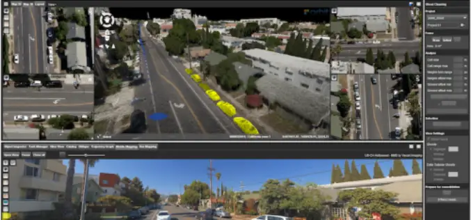
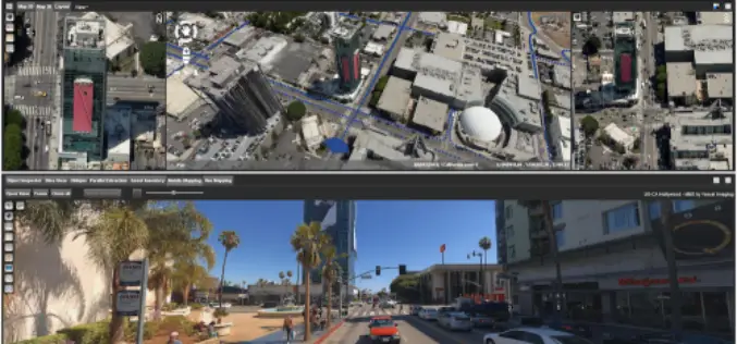
Applanix Introduces its Autonomy Development Platform for Accelerating Research, Development, and Production of Autonomous Vehicles
Richmond Hill, Ontario, January 23, 2018 — Applanix, a Trimble Company and leader in positioning and orientation technology, introduced today its Autonomy Development Platform to provide automakers, truck makers, and Tier 1
Blue Marble Geographics Adds Chinese Reseller to its Worldwide Network of Partners
Hallowell, Maine – December 19, 2017 – Blue Marble Geographics (bluemarblegeo.com) is pleased to announce that Beijing E-Carto Technologies Co., Ltd. has joined the growing list of partner companies reselling and

4th Edition of GIS Resources Magazine: Advances & Applications of Geospatial Technologies in Earth Sciences
GIS Resources Magazine (4th Edition): Advances & Applications of Geospatial Technologies in Earth Sciences GIS Resources, a leading global platform for latest and high-quality information source for the geospatial industry, announcing

YellowScan and Geotrim Sign a Distribution Agreement for Finland
Montpellier, 15 December 2017 – YellowScan and Geotrim have concluded a distribution agreement for Finland. Headquartered in Vantaa, Geotrim is the Finnish Distributor of Trimble Geomatics solutions with long time experience
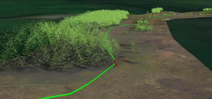
National Grid Trial Aerial LiDAR Inspection for Gas Network
December 12, 2017 – National Grid have announced they are conducting a trial programme using laser scanning data to deliver safety and operational efficiency improvements across their network. In a UK
Create Photogrammetric Point Cloud Using Global Mapper Pixels-to-Points Tool
Global Mapper LiDAR Module v.19 Now Available with Pixels-to-Points™ Tool for Photogrammetric Point Cloud Creation November 29, 2017 – Blue Marble Geographics is pleased to announce the release of version 19 of the

Global Mapper SDK Now Available on Amazon Web Services
Hallowell, Maine – November 16, 2017 – Blue Marble Geographics (bluemarblegeo.com) is pleased to announce that the Global Mapper Software Development Kit (SDK) has been expanded to provide data processing capabilities
Orbit GT Releases 3D Mapping Feature Extraction Standard v18
Orbit GT launches the 3D Mapping Feature Extraction Standard product version 18. “We’re pleased to announce the release of our second product from the Feature Extraction portfolio”, says Peter Bonne,
