
Tag "LiDAR"

Space Flight Laboratory (SFL) Selected by NUVIEW to Develop Pathfinder Satellite Bus for Its Space-Based LiDAR Constellation
Space Flight Laboratory (SFL) has been chosen by NUVIEW, a space-technology company specializing in 3D Earth imaging, to develop the bus for Mr. SPoC, its pathfinder small satellite that will

Purana Qila LiDAR Survey to Guide ASI’s New Excavation in Search of Indraprastha
The Archaeological Survey of India (ASI) is set to resume its excavation efforts at Purana Qila, one of Delhi’s most significant archaeological sites, in search of evidence related to Indraprastha,
LiDAR in Traffic Management: UDOT’s Plan for Safer Intersections
The Utah Department of Transportation (UDOT) is spearheading an innovative project that leverages LiDAR in traffic management to enhance safety and efficiency at key intersections. Launched in March 2024, this

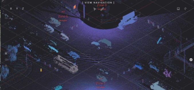
LiDAR Survey for Landslide Risk Management in Uttarakhand
In a recent executive committee meeting of the Uttarakhand Landslide Reduction and Management Centre (ULMMC), Chief Secretary Radha Raturi underscored the urgency of bolstering landslide management and mitigation efforts in

Azerbaijan Exploring Offshore Wind Potential with LiDAR Technology
Azerbaijan has significantly advanced its renewable energy initiatives with the launch of a LiDAR (Light Detection and Ranging) project designed to measure offshore wind potential in the Caspian Sea. This

What is Digital Twin and How Does It Work?
In today’s rapidly evolving technological landscape, Digital Twin technology has emerged as a groundbreaking innovation, especially in the geospatial sector. Digital twins are virtual replicas of physical entities that mirror

Northeast Frontier Railway (NFR) to Conduct Airborne LiDAR Survey
The Indian Railway’s Northeast Frontier Railway (NFR) zone is set to conduct an Airborne LiDAR Survey on the Lumding to Badarpur hill section. This advanced survey will take place during
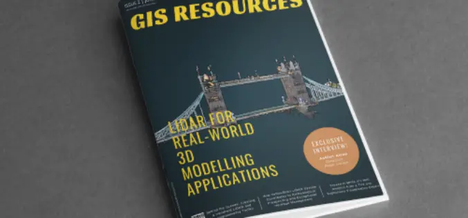
GIS Resources Magazine (Issue 2 | June 2022): LiDAR For Real-World 3D Modelling Applications
GIS Resources is pleased to announce the publication of its 2nd edition (June 2022) of the print and digital magazine. The edition titled “LiDAR For Real-World 3D Modelling Applications.” The LiDAR

RIEGL VZ-i Line Scanners for Permanent Monitoring Applications and Integration Capabilities into Customers Risk Management
In the context of climate change and the expansion of areas of urban settlement, e.g., in Alpine regions, the demand for high-quality datasets as well as the integration into risk
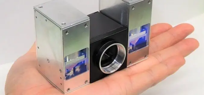
Toshiba Palm-sized LiDAR with a Range of 300m
Toshiba recently announced significant progress in downsizing the laser projector portion of their LiDAR to one-quarter the size of the previous iteration, which was introduced in June 2021. Using two
