
Tag "LiDAR"

GeoSLAM and Bentley Systems Join Forces to Take Mobile Reality Modelling Indoors
BENTLEY YII 2017, SINGAPORE, OCTOBER 5, 2017 – GeoSLAM – the experts in “go anywhere” 3D mobile mapping technology, and Bentley Systems, a leading global provider of comprehensive software solutions for advancing infrastructure,
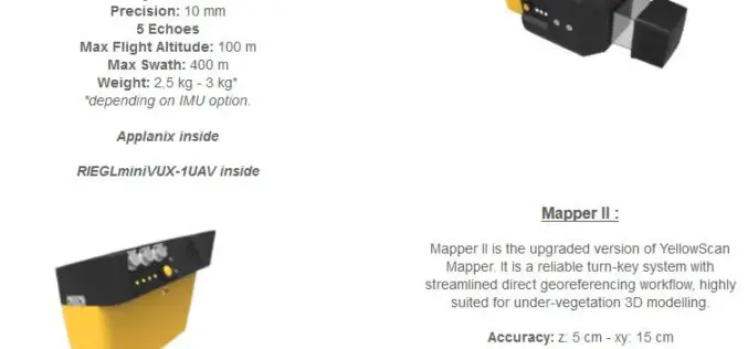
YellowScan Unveils Its Next Generation UAV-LiDAR Systems
Montpellier, 21 September 2017 – YellowScan is committed to provide the most reliable integrated imaging systems and customer support for demanding UAV applications. Since 2012, the team’s dedication to fulfill high resolution and high-quality survey
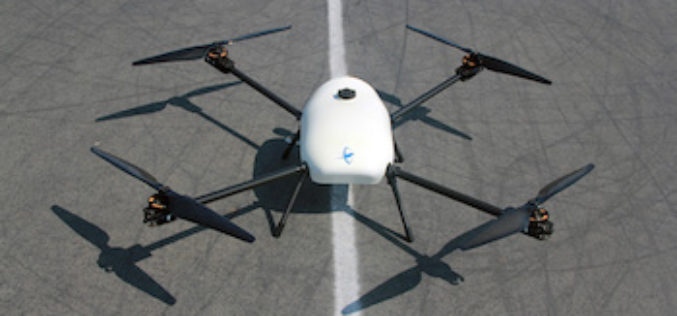
Skyfront Sets World Record for Drones with 4 Hour and 34 Minute Flight
Skyfront invents hybrid-electric drone technologies to enable monitoring of large, remote assets in challenging terrain for the Utility, Agriculture and Energy industries. MENLO PARK, CA, SEPT. 12, 2017 – Skyfront,
Terra Drone Dedicated Image Processing Software Terra Mapper Begins Sales of Its Cloud Version and Desktop Version at the Same Time
Terra Drone dedicated image processing software “Terra Mapper” begins sales!! ~Cloud version and desktop version release at the same time~ Terra Drone Co., Ltd. (Head Office: Shibuya-ku, Tokyo, CEO: Tokushige
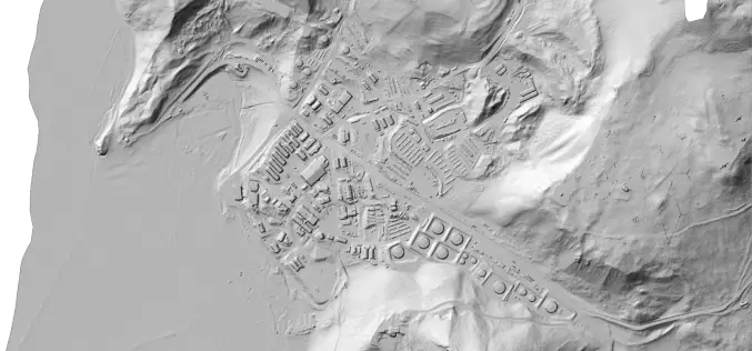
Portland State Laser Mapping Project Shows Global Warming Effects in Antarctica
(Portland, Ore.) Aug. 9, 2017 – Portland State University researchers and the National Science Foundation (NSF) have publically released high-resolution maps of the McMurdo Dry Valleys, a globally unique Antarctic

Velodyne LiDAR Appoints Robert Brown as Chief Financial Officer
August 08, 2017 – SAN JOSE, Calif.–(BUSINESS WIRE)–Velodyne LiDAR Inc., the world leader in 3D real-time perception systems for autonomous vehicles, today announced Robert (Bob) Brown has joined the company as

Boeing and JAXA to Flight-test Technology to Improve Safety
SEATTLE, Aug. 2, 2017 /PRNewswire/ — Boeing [NYSE: BA] and the Japan Aerospace Exploration Agency (JAXA) will flight-test Long-range Light Detection and Ranging (LIDAR) technology next year. This remote-sensing technology could help commercial
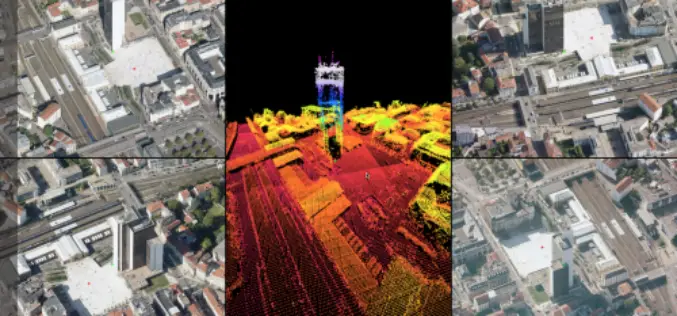
Orbit GT Updates 3D Mapping Cloud With Oblique Imagery Support
“After support for Mobile Mapping and UAS Mapping content, we now proudly announce the support for Oblique Imagery and Aerial Point Clouds. From now on, anyone owning Oblique data can
USACE Mobile District Signs WMR-532 to $46M Coastal Mapping Contract
WMR-532, the joint venture of Woolpert and Optimal Geo, will provide bathymetric and topographic lidar and imagery in support of JALBTCX task orders around the world. DECATUR, Ala. (July 26,
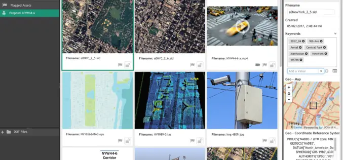
LizardTech and Extensis Optimize Digital Asset Management for Geospatial Data
LizardTech and Extensis Optimize Digital Asset Management for Geospatial Data Latest Version of Extensis Portfolio Extends DAM to Geospatial Industry; Solution Indexes, Catalogs, Shares MrSID Files Portland, Ore.— July 19, 2017 — LizardTech®
