
Tag "mapping"
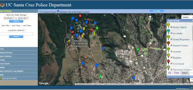
UC Santa Cruz Police Department has Launched Crime Mapping Website
According to recent news by the UC Santa Cruz, the UC Santa Cruz Police Department has launched a new website mapping crime reports on the UC Santa Cruz campus community. The new website

New 3D Mapping Technology for Smart City Development
The two most commonly used 3D mapping techniques are photogrammetry using satellite or aerial imagery, and laser scanning. The former offers greater accuracy in the horizontal direction and the latter

Mapping & Geospatial Industry in India to Grow Manifold in a Decade
Hyderabad – PTI – The mapping and geospatial technology area in the country are estimated to witness business of a whopping Rs 1 lakh crore in the next 10 years, Surveyor
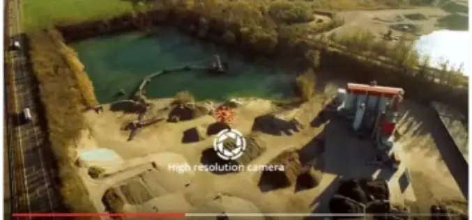
5 Drones for Precision Agriculture on Geo-matching.com
Drones (also known as Unmanned Aerial Vehicles) are used for various applications such as surveying, surveillance and habitat mapping. An interesting new application is precision agriculture. Drones can be used
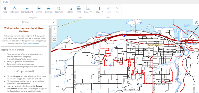
WebMap: Hood River County Releases New GIS Mapping Tool
Hood River County Geographic Information Services (GIS) Department has recently launched unveil a beta version of its interactive online WebMap application. The Hood River County Webmap application and its underlying
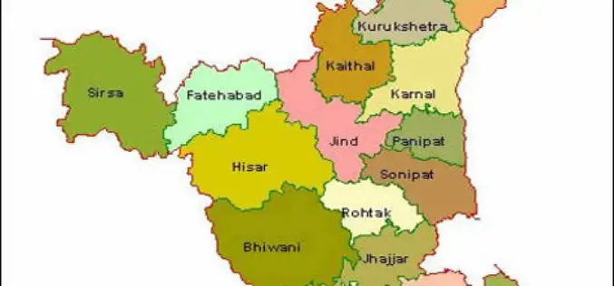
HARSAC Uses Drones to Create “Most Accurate Maps” of Gurugram for Land Records Management
New Delhi : Haryana State Remote Sensing Application Centre (HARSAC) and local administration made optimum use of the technology at their disposal as they used 24 satellites and drones to
Woolpert Contracted to Collect Orthoimagery for Ohio
COLUMBUS, Ohio (Jan. 4, 2017) — Woolpert has been contracted to acquire high-resolution orthoimagery for the entire state of Ohio, which is roughly 41,276 square miles, by the Ohio Geographically
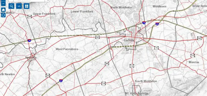
Cumberland County Launches New Property Mapper Application
Cumberland County, PA, January 3, 2017- At their public meeting today, the Cumberland County Board of Commissioners announced the release of a new online property mapper application now available to

Illinois Wesleyan University Selects Geospatial Corporation’s GeoUnderground and GIS-Centric Smart-Asset Management Technologies
GeoUnderground Deployed to Improve Infrastructure Capital and Business Planning Pittsburgh Pennsylvania – December 19, 2016– Geospatial Corporation (OTCQB Symbol “GSPH”), a leading innovator of asset management/analytics/mapping software and 3D mapping
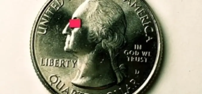
Velodyne LiDAR Announces Breakthrough Design for Miniaturized, Low-Cost Solid-State LiDAR Sensors
Application of integrated circuitry leads to a new approach to LiDAR sensors for the autonomous vehicle, 3D mapping, and drone industries MORGAN HILL, Calif.–(BUSINESS WIRE)–Velodyne LiDAR Inc., the recognized global
