
Tag "mapping"

Humanitarian OpenStreetMap Team – Malaria Mapping YouthMappers Challenge
Humanitarian OpenStreetMap Team member Mr. Russell Deffner along with Geoffrey Kateregga are managing a mapping project for malaria eradication across seven countries in Southern Africa, Southeast Asia, and Central America.

Leveraging 3D Modeling and Printing Skills as a Service: Mapping the Abbey of Chateliers and Church of Ars-en-Ré
In order to explore how to better expand and improve their services, French photography and photogrammetry-based service provider Unautregard teamed up with Planète Sports &Loisirs and 3D Arcwest, to capture,

South Korea Government Using Drones to Map Hazardous Areas
According to recent news by Korea Bizwire – On Tuesday, the Ministry of Land, Infrastructure and Transport demonstrated its latest 3D-mapping technology that makes use of drones, at the Han River
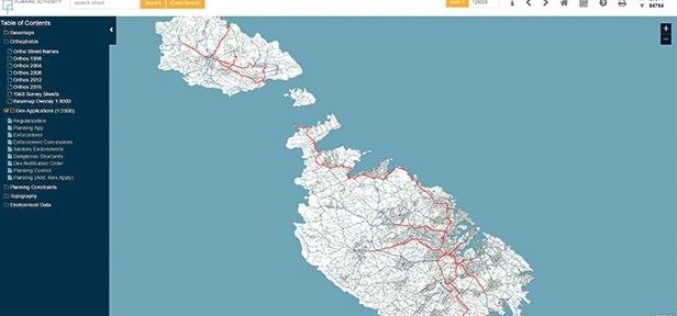
Planning Authority of Malta Launch New Online Mapping System
According to recent news by the Times of Malta, the Planning Authority has launched an online geographic information system (GIS), that would allow the public to access data in a faster
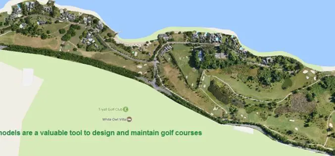
Three Reasons Golf Courses Are the Next Drone Mapping Territory
The emerald golfing greens have seen better days. According to the US National Golf Foundation, the number of players has almost steadily declined from over 30 million in 2005 (pre-recession),
Golden Software Releases Surfer 2D and 3D Mapping, Modeling, and Analysis Software
Latest Version Includes Contour Line and Grid Editing Features, User Interface Improvements, Image Georeferencing, Streamlined Workflows, and Access to Online Data. GOLDEN, COLORADO, February 14, 2017 – Golden Software, the

Leica Geosystems Partners with Geolantis to Integrate a Cloud Based Utility Mapping Platform
(Heerbrugg, Switzerland; Klagenfurt, Austria, 8 February 2017) – Leica Geosystems, global leader of measurement and digital reality capture technologies, has teamed with Geolantis, a provider and developer of the best-in-class

OGC to Initiate Phase 1 Development of Interoperability Standards for Underground Infrastructure Data
7 February 2017 – The Open Geospatial Consortium (OGC®) is pleased to announce that the Fund for the City of New York and its sister organization, the National Center for Civic
OmniEarth Applies Machine Learning to Multiple Satellite Sources for Improved Soil Moisture Mapping
The US Defense Advanced Research Projects Agency (DARPA) has awarded OmniEarth a Small Business Innovation Research (SBIR) Phase I contract to develop a precision soil moisture mapping model in support
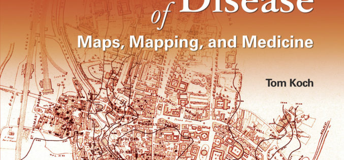
Putting Disease on the Map
Esri Book Offers a Sweeping Historical Overview of Medical Mapping in a New, Expanded Edition of Cartographies of Disease: Maps, Mapping, and Medicine January 31, 2017 – Redlands, California—The new
