
Tag "Mississippi"
GIS
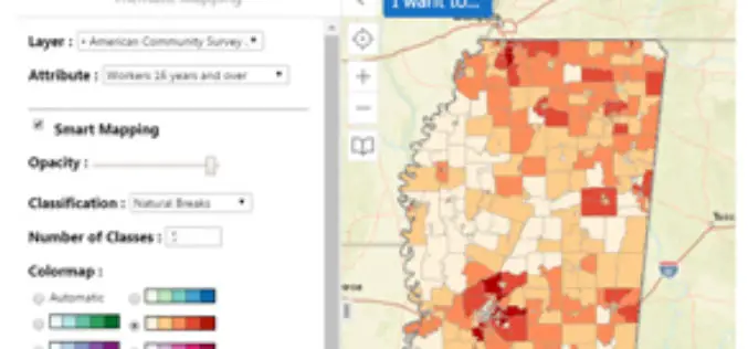
Mississippi State University Released a New Web Application “GeoDawg” – Bringing Power of GIS to the Public
STARKVILLE, Miss.— The Geosystems Research Institute (GRI) at Mississippi State University has released a new web application, “GeoDawg,” that gives Mississippians the ability to easily use the capabilities of a
Business
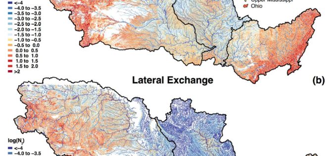
Uncovering the Mighty Mississippi’s Natural Potential for Nitrogen Removal
Working throughout the Mississippi River basin, USGS scientists and collaborators from the University of Texas at Austin have established the river’s own potential to decrease its load of nitrate and
Business
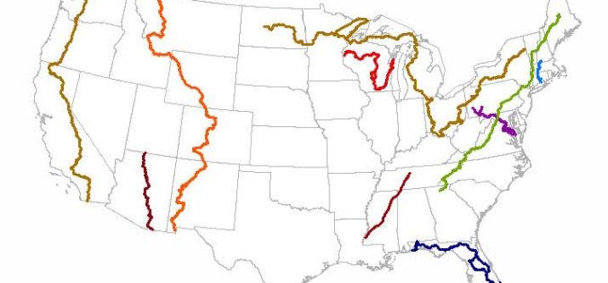
New Magnolia State Maps Adding Trails
Several of the 772 new US Topo quadrangles for Mississippi now display parts of the Natchez Trace National Scenic Trail and other selected public trails. Further significant additions to the
