
Tag "Point clouds"
FOSS4G NA 2016: Open Source Photogrammetry with OpenDroneMap
OpenDroneMap (ODM) aims to be a full photogrammetric solution for small Unmanned Aircraft (drones), balloons, and kites. ODM acts as a tool for processing highly overlapping unreferenced imagery, turning the
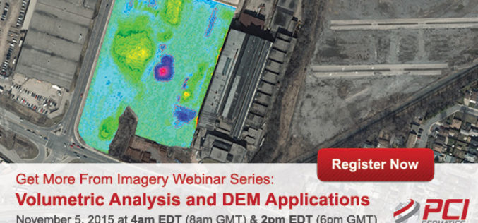
Volumetric Analysis and DEM Applications Using PCI Geomatica
Volumetric Analysis and DEM Applications Nov. 5, 2015 at 4am EDT (8am GMT); Nov. 5, 2015 at 2pm EDT (6pm GMT) PCI Geomatics is the developer of Geomatica- a complete and

Open Source Software for Bulk LiDAR Data Processing Released
Developed for Forest Carbon Monitoring to Support Reducing Emissions from Deforestation and Forest Degradation (REDD+) in Kalimantan, Indonesia; Now Available for Public Use. For this project, Applied GeoSolutions and the
4Dmapper to Store, Deliver and to Share Geospatial Data
4Dmapper is a web based geospatial product. If you are thinking that it is same as Google Earth or Bhuvan; NO, 4Dmapper is a rich, purely browser based 3D environment
PR: LAStools Toolbox for ERDAS IMAGINE 2014 Released
The latest release of LAStools from rapidlasso GmbH contains a new toolbox for ERDAS IMAGINE 2014, allowing the users of Hexagon Geospatial’s powerful remote sensing software to utilize the popular rapidlasso LiDAR processing modules. The tools
