
Tag "Radar images"
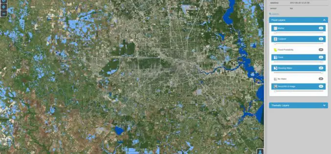
DLR Provides Satellite Data for Hurricane Harvey
DLR provides satellite data for Hurricane Harvey Radar images from TerraSAR-X German Aerospace Center (DLR) provides real-time recordings and archive data of the German radar satellite TerraSAR-X. DLR supports hurricane
Earth Observation for Humanitarian Aid
Earth observation satellites fly at distances of up to several hundred kilometres from Earth and can provide detailed information that assists relief workers on the ground. Now, this technology will
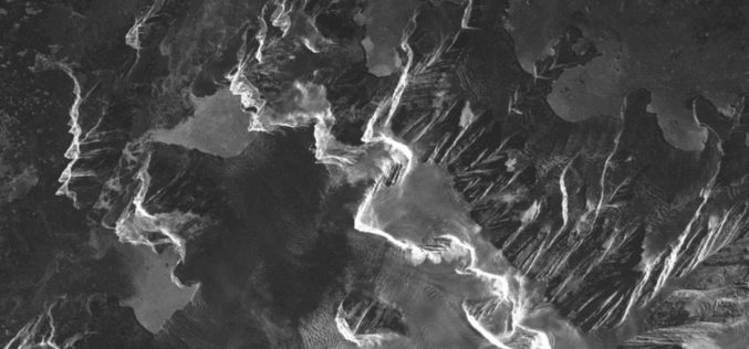
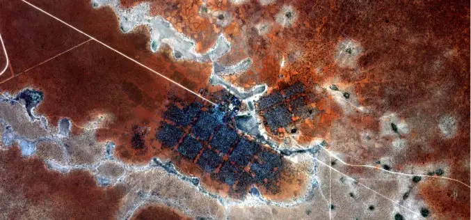
Safer Seafaring with Satellites – DLR Produces Radar Images at Its Antarctic Station in Near Real Time
Sailing in the regions that polar researcher Arved Fuchs is currently navigating in his ship ‘Dagmar Aaen’ is a not an easy task. The ‘Ocean Change’ expedition is travelling around
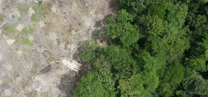
Radar Satellite Data for Mapping Dynamics of Deforestation and Forest Degradation
Have you ever think about the importance of forests in our daily lives of concrete jungles? Forests products are used in our daily lives. All activities directly or indirectly involve
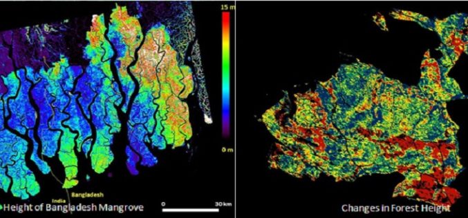
Mapping Forest Structure From Space
Over the last 10 years a new method using satellite radar data has been maturing to provide 3D views of Earth’s natural resources and urban environments. Scientists from around the
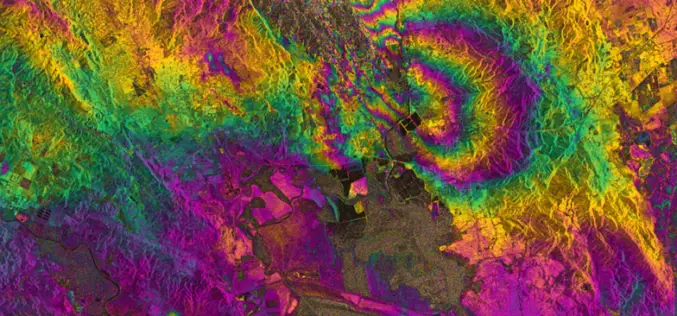
RADAR Vision Maps Napa Valley Earthquakes
Sentinel-1A has added yet another string to its bow. Radar images from this fledgling satellite have been used to map the rupture caused by the biggest earthquake that has shaken
