Safer Seafaring with Satellites – DLR Produces Radar Images at Its Antarctic Station in Near Real Time
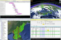
Sailing in the regions that polar researcher Arved Fuchs is currently navigating in his ship ‘Dagmar Aaen’ is a not an easy task. The ‘Ocean Change’ expedition is travelling around the Antarctic Peninsula, stopping off at a number of research stations to investigate how climate change is impacting the local environment. The expedition receives support from the German Aerospace Center (Deutsches Zentrum für Luft- und Raumfahrt; DLR), and the ship has now reached Deception Island. The DLR Earth Observation Center (EOC) is providing the crew with high-resolution radar images acquired by the German TerraSAR-X and TanDEM-X satellites. The data from space is received at the DLR German Antarctic Receiving Station at O’Higgins Base (GARS O’Higgins), automatically processed on the ground in near real-time (NRT), and then transmitted directly to the ship. The ‘Dagmar Aaen’ crew can access the images to navigate the icy world of the Antarctic just one to two hours after they were acquired.
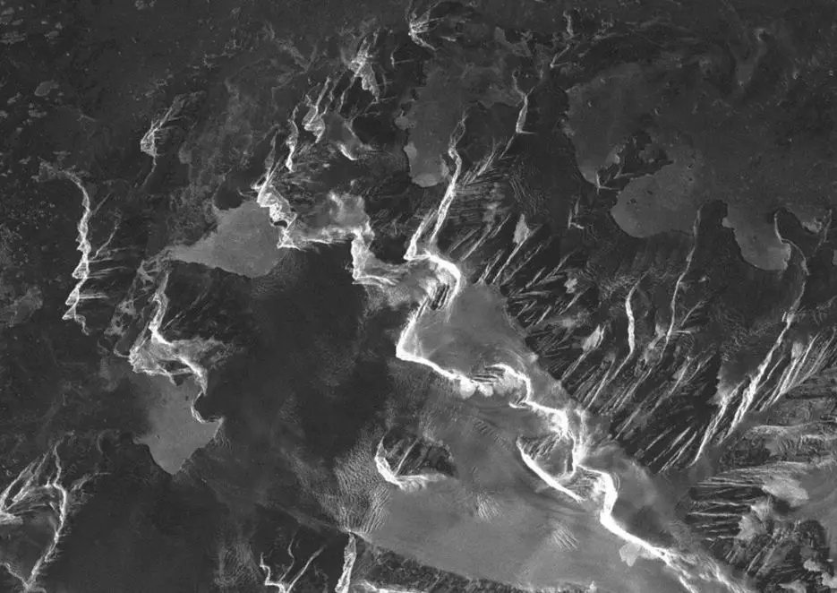
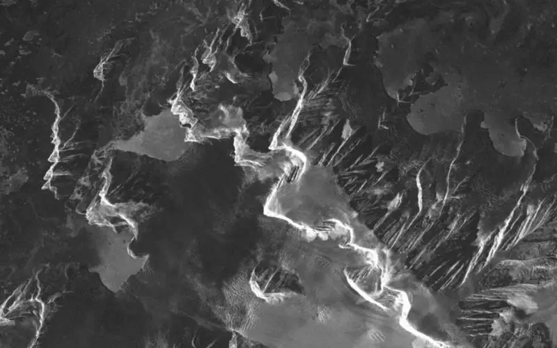
Radar image of the Lemaire Channel on the Antarctic Peninsula
Data for safe navigation
“Since the beginning of this year, not only have we been able to receive satellite data here in our Antarctic station, but we have been in a position to process the information on behalf of users in near real-time,” explains DLR researcher Kathrin Höppner. To accomplish this, the ship transmits its position to EOC in Oberpfaffenhofen, which then instructs the two satellites to acquire images of the relevant region roughly 24 hours later. These space images are extremely useful for Arved Fuchs: “The satellite images provide information that would have been unimaginable for previous generations of seafarers. This imaging system will revolutionise the process of selecting the correct route and is certain to make navigation significantly safer.”
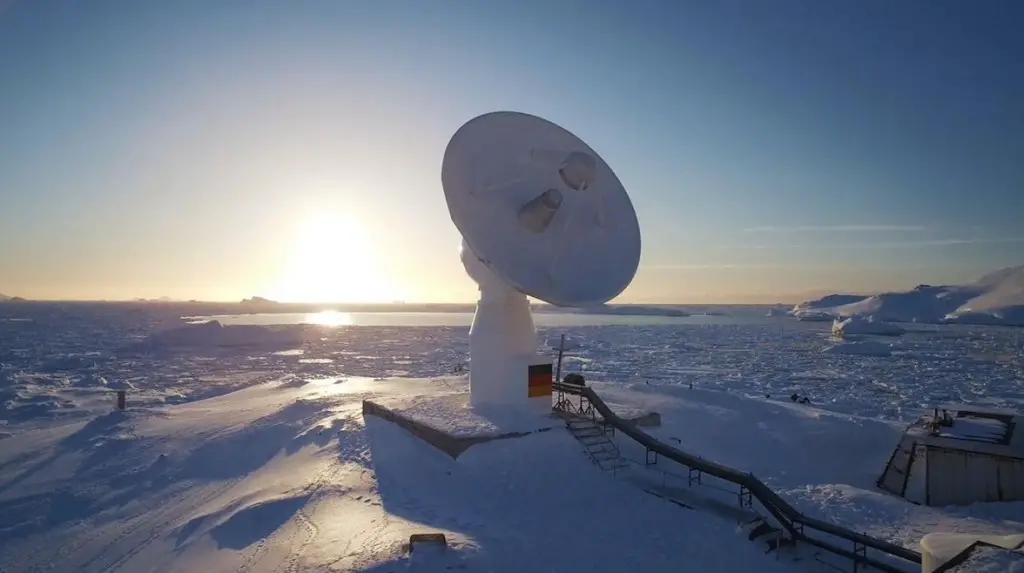
DLR Antarctic Station GARS O’Higgins
Detecting small icebergs
The advantage of radar images – compared with optical satellite data – is that they can be acquired regardless of the time of day or the presence of cloud cover. They clearly show which expanses of water are covered by ice and what routes would provide ships with relatively unobstructed travel. “The high-resolution images we receive show the crew exactly where the water is covered by ice,” says Höppner. The image products have a spatial resolution down to three metres. The radar satellites are even able to detect small icebergs, and they provide a KML (Keyhole Markup Language) file to enable the assessment of ice conditions using the Google Earth program. In return, the ship’s crew sends on-site data and information to the DLR researchers, which they use to validate and expand the NRT service.
Arved Fuchs and ‘Dagmar Aaen’ will continue their expedition around the Antarctic Peninsula, investigating climate change and how it impacts the southernmost continent, until the end of February 2016. During this time, the radar satellites be their ‘guides’.