
Tag "Sentinel-3"

Copernicus Satellite Data for Cultural Heritage Monitoring and Preservation
The free and open data and information delivered by the Copernicus programme represents a valuable resource for Cultural Heritage monitoring and preservation at European and global level. The data and
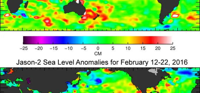
Jason-3 Begins Mapping Oceans
Just over a month after launch, Jason-3, a U.S.-European oceanography satellite mission with NASA participation, has produced its first complete science map of global sea surface height, capturing the current
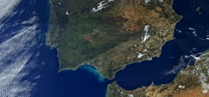
First Views of Earth From Sentinel-3
ESA– The first image from Sentinel-3A captures the transition from day to night over Svalbard, Norway, with detailed Arctic sea ice and some cloud features. Just after two weeks after
Learn What Sentinel-3 Will Tell Us About Oceans
Most of our planet is covered by oceans, which are directly linked to our weather and climate, and so play a key role in our well-being and economy. Still our
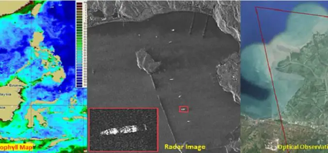
Free and Open Access to Sentinel-1 and Sentinel-3 Data Would Contribute To the Indonesian Blue Revolution
The Indonesian archipelago is one of the most important reservoirs of marine biodiversity on the planet, which makes a substantial contribution to the local fishing, aquaculture and tourism industries. Illegal
