
Tag "Sentinel-3A"
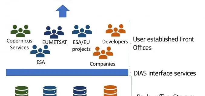
The Upcoming Copernicus Data and Information Access Services (DIAS)
The European Commission (EC) has launched an initiative to develop Copernicus Data and Information Access Services (DIAS) that facilitate access to Copernicus data and information from the Copernicus services. By
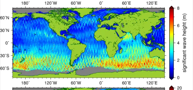
New Suite of Products Available For SRAL Instrument on the Copernicus Sentinel-3a Satellite
The Synthetic Aperture Radar Altimeter (SRAL) instrument on board Sentinel-3A delivers accurate measurements of sea surface height, significant wave height and surface wind speeds over the world’s oceans for Copernicus

Sentinel-3A Sea & Land Surface Temperature Radiometer (SLSTR) Level-1B Data is Now Available at Near Real Time (NRT) Timeliness
Sentinel-3 is primarily an ocean mission, however, the mission will also be able to provide atmospheric and land applications. The mission will provide data continuity for the ERS, Envisat and
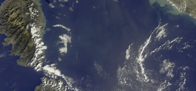
First Earth Colour Data Released by Sentinel-3A
20 October 2016 – The Copernicus Sentinel-3A satellite has taken another step towards being fully ‘operational’ as the first data from its Ocean and Land Colour Instrument are made available
