
Tag "South China Sea"
Business
East View Expands South China Sea Imaging Capabilities
MINNEAPOLIS, Minn. – January 31, 2017 – East View Geospatial is enthusiastic to announce the expansion of analytic services in the South China Sea for foundation data and satellite imagery.
GIS
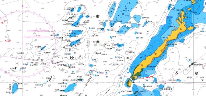
Old Map Denies the Philippines’ Claim Over South China Sea
NEW YORK – An old map published in 1899 by geographer J. Martin Miller shows that islands in the South China Sea have never been Philippine territory, Zeng Yingjing, the
GIS
What’s Drives China in the South China Sea? A GEOINT View
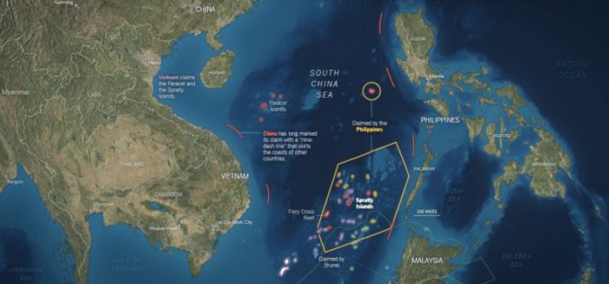
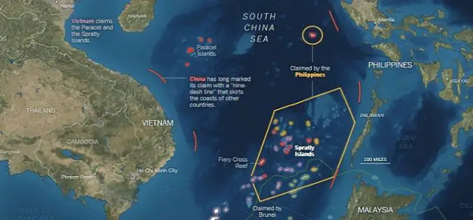
Contributed By: The Spratly Islands are a group of more than 750 reefs, islets, atolls, cays and islands in the South China Sea. The history of territorial claim on these
