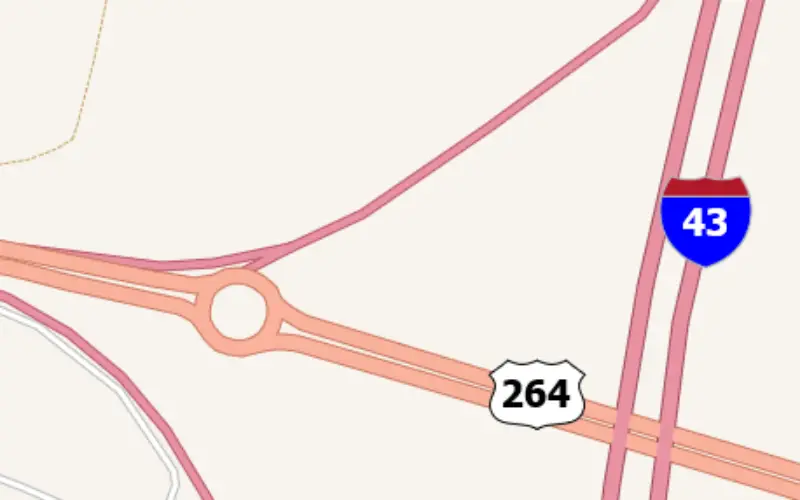
TatukGIS announces integrated support for highway and route shields in its GIS SDK and desktop GIS products. A built-in SVG symbols library provides easy access to shields commonly used to label road and highway maps in the United States, Canada, Europe, and countries around the world.
Though it was always possible for customers to use their own road shields in TatukGIS projects, creating shields like used for U.S. highway and route maps were challenging. The new road shields library is implemented as an extension to the existing TatukGIS labeling mechanism, so applying a shield to a road class is now just a matter of selecting a shield from the library and specifying a font size. A labels allocator prevents shields from overlapping.
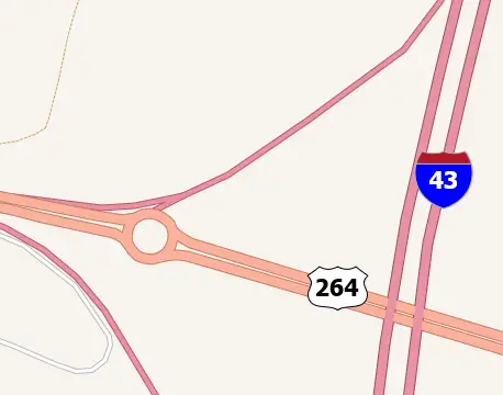
Road shields, furthermore, are auto-scaled horizontally to efficiently accommodate labels of varying lengths.
The TatukGIS symbols library can be further expanded. Customer requests and suggestions are welcome.
Learn more about TatukGIS products at www.tatukgis.com.
Also, read – TatukGIS Releases SDK for ASP.NET Core