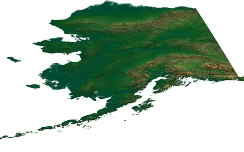
More than 400 new topographic maps are now available for the state of Alaska. The new maps are part of the U.S. Geological Survey Alaska Mapping Initiative, to update foundational data for the state and to replace the existing maps that are about 50 years old.
“These new digital maps of Alaska are elevating our visual record of the surface of the state to 21st century levels,” said Anne Castle, Assistant Secretary of the Interior for Water and Science. “The associated
The first 400-plus new US Topo maps for Alaska are now accessible and are the beginning of a multi-year project, ultimately leading to more than 11,000 new maps for the entire state. The goal of the AMI is the production of a complete series of digital topographical maps at a scale of 1:25,000 to replace the 1:63,360-scale maps produced about 50 years ago. The maps will be published in digital PDF format (GeoPDF©) and are available for free download and manipulation on a computer.
These new maps include several layers, with an option for the user to turn them on or off. Major updated features include:
- Satellite image layers which allows a recent view of the earth’s surface.
- Contours and shaded relief layers showing the lay of the land derived from newly acquired 5-meter radar elevation data.
- Surface water features from the USGS National Hydrography Dataset, which are updated by local stewards and USGS.
- Glaciers updated using Randolph Glacier Inventory data.
- Boundaries integrated from multiple sources, including Census and major Federal landholders.
- The Public Land Survey System layer from the Bureau of Land Management.
- Roads from a commercial vendor under a USGS contract.
- Railroads and the Trans-Alaska oil pipeline data from local sources.
- Important buildings including police stations, schools, and hospitals.
- Airports, heliports and seaplane landing strips compiled by USGS from multiple sources.
- Feature names from the USGS-maintained Geographic Names Information System.
To ensure that the maps meet current accuracy specifications and standards, the maps will be made using newly acquired elevation and imagery data from multiple state, federal and commercial sources. The map-making process will be largely automated using software specially adapted by the USGS to create approximately 11,275 digital map quadrangles, covering the entire area of the state.
Mapping in Alaska did not keep pace with records for the rest of the nation as a result of difficult terrain, remote locations, and vast distances. Modern mapping information does not exist over the majority of land in the state. Prior to this effort, topographical maps for much of Alaska were about 50 years out of date and not produced to current standards, which rely largely on high resolution digital imagery and elevation data. As a consequence, essential public services have suffered, among them transportation planning and safety, urban and regional planning, economic development, natural resource management, conservation and scientific research.
This new generation of digital topographic maps will continue the rich and valuable USGS cartographic history, and serve the Nation by providing reliable scientific information to describe and understand the Earth; minimize loss of life and property from natural disasters; manage water, biological, energy, and mineral resources; and enhance and protect quality of life.
For more information and download, go to: http://nationalmap.gov/alaska
Source: USGS