Esri India Webinar on SAR Interferometry using SARScape tool for ArcGIS
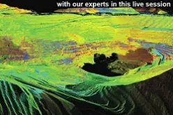
The use of Synthetic Aperture Radar (SAR) data has become increasingly popular in recent years, offering professionals in a wide array of industries a measurable, analytical approach to getting information about an area or object of interest. SAR data, acquired from airborne and spaceborne platforms, enable the generation of two or three-dimensional products of the Earth’s surface.
ENVI SARscape® allows you to easily read, process, analyze your SAR data, and generate products, while giving you the option to integrate this information with other geospatial products. This unique data analysis capability takes your data from hard-to-interpret numbers to meaningful, contextual information.
Key highlights
- Generating complex images (SLC), co-registration, calibration, despeckling, segmentation and classification
- Intensity processing of SAR data for crop identification
- Interferometric SAR (InSAR) analysis to generate Digital Elevation Model
- DInSAR analysis for to Surface deformation maps
- Overview of Displacement mapping using Interferometric Stacking
Who should attend?
Geospatial professionals from Agriculture, Forestry, Environment, Meteorology, Space Application, Geology, Geography, Remote Sensing, and GIS.
Speakers:
- Krishna Rao TVB, Head of Technical Support, Esri India
- Partha Pratim Ghosh, Technical Manager, Esri India
Date and Time: Thursday, January 21, 2016 1:30 pm
Singapore Time (Singapore, GMT+08:00)
Duration: 1 hour
Join the free Esri India webinar to understand how data acquired from recent SAR sensors can be used to generate accurate (up to a vertical resolution of few meters) and detailed surface and terrain height products and its various applications.
Register Now