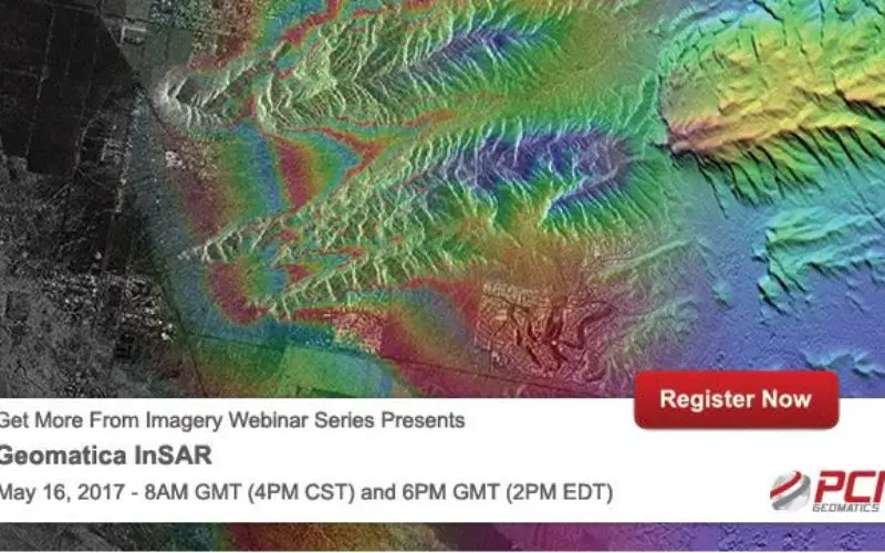
PCI Geomatics Webinar: Geomatica Object Analyst
May 16, 2017 | 8AM GMT / 4PM CST & 6PM GMT / 2PM EDT
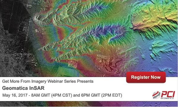
In this webinar, we’ll take a deep dive into the new InSAR processing module available with Geomatica 2017. Geomatica’s InSAR module offers an easy to use and powerful set of processing tools to work with interferometric Synthetic Aperture Radar (SAR) imagery to derive deformation maps and extract elevation models.
Deep stacks of InSAR pairs can be analyzed to derive cumulative deformation or velocity of deformation changes. Attendees will be able to download the Geomatica 2017 trial software and work with a RADARSAT-2 InSAR pair to derive deformation and elevation products.
What You’ll Learn
- Overview of the InSAR module and key components
- Supported data formats and sensors
- Best practices for image acquisition and scene selection
- Processing to derive deformation products
- Processing for elevation information extraction
- Quality assurance steps and best practices (using quality reports, coherence maps, etc to guide decision making through the processing of InSAR imagery
Speaker:
- David Piekny
Product Marketing Manager
PCI Geomatics - Shawn Melamed
Technical Solution Specialist
PCI Geomatics
REGISTER NOW
Categories:
Webinars