
Archive
What is Geodesy?
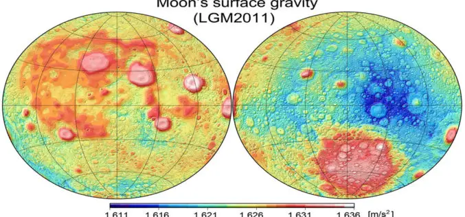
What is Geodesy? Geodesy is the science which deals with the methods of precise measurements of elements of the surface of the earth and their treatment for the determination of

Maximum Value Composite Images (MVC’s): A solution for Cloudy Image to calculate NDVI
When the satellite views an area at any one time, a large part of the image may be cloud, which has a very low NDVI (approximately 0.002). This gives no

Total Station And Its Applications In Surveying
1. Introduction The Total station is designed for measuring of slant distances, horizontal and vertical angles and elevations in topographic and geodetic works, tachometric surveys, as well as for solution

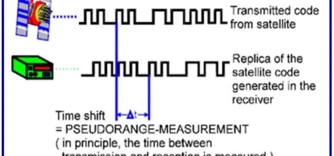
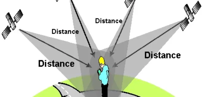
Possible Applications of GPS
Since GPS is all-weather, real-time, continuously available, economic and very precise positioning technique, almost unlimited possibilities are opened up for its use in geodesy, surveying, navigation and related fields, including
GPS Field Observation and Data Processing
1. Planning of GPS observation Before starting a GPS Survey Campaign, the following points should be kept in mind. 1.1. Pre Survey planning:- A satellite “sky plot” or visibility chart
GPS Surveying Techniques
There are wide variety of GPS applications, which is matched by a similar diversity of user equipment and techniques. Nevertheless, the most fundamental classification system for GPS technique is
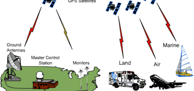
Introduction to GPS
GLOBAL POSITIONING SYSTEM 1. Introduction The NAVSTAR Global Positioning System (GPS) is a satellite-based radio positioning and time – transfer system designed, financed, deployed and operated by US Department of
Fundamemtals of Hyperspectral Remote Sensing
Introduction Hyperspectral remote sensing is the science of acquiring digital imagery of earth materials in many narrow contiguous spectral bands. Hyperspectral sensors or imaging spectrometers measure earth materials and produce

Hyperspectral Remote Sensing
Hyperspectral remote sensing is the science of acquiring digital imagery of earth materials in many narrow contiguous spectral bands. Hyperspectral sensors or imaging spectrometers measure earth materials and produce complete spectral
