
Archive

SuperGIS 3D Earth Server 3.2 Officially Launched
Supergeo Technologies, the leading global provider of complete GIS software and solutions, officially released SuperGIS 3D Earth Server 3.2, to assist enterprises in managing, integrating, publishing and displaying geographic data
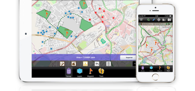
Comsoft Paris Uses SuperSurv 3 to Extend Enterprise Solutions
Supergeo Technologies, the leading global provider of complete GIS software and solutions, announced that Comsoft Paris selected SuperSurv, the data collection app for Android and iOS platforms, to extend business

Remote Sensing and Earth Observation Fields Webinar – NSW
The webinar aims to bring together people who are working in the remote sensing and earth observation fields to hear how these professionals are using earth observation data for their

GeoMax Zipp10 Pro With Handy New Additions to the Entry Level Total Station
GeoMax has introduced some first class improvements to the Zipp10 Pro Total Station Series, designed to make sure the data you need is always at hand. A USB port and
New GIS Smartphone App Launched by NCSI at COMEX 2014
Muscat | 6 April, 2014 – The COMEX 2014 exhibition, which opened its doors at Oman International Exhibition Centre on April 7, features a comprehensive presence from The National Centre for

The International Space Apps Challenge
The International Space Apps Challenge is an international mass collaboration focused on space exploration that takes place over 48-hours in cities around the world. The event embraces collaborative problem solving
Understanding Shapefile (.shp) File Format
Shapefile is a vector data format for storing geographical data and associated attribute information. It is developed and regulated by Esri as open specification for data interoperability among Esri and other GIS software products. Shapefile

Europe Lofts First Copernicus Environmental Satellite
3 April 2014-The ability of European citizens, policymakers and service providers to access key environmental data on a routine basis will take a major step forward following the launch today

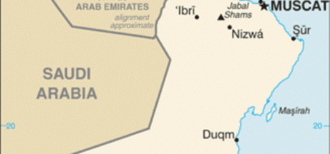
UNDP to Support Saudi in Geospatial Capacity Building
In recent news, the UN Development Program (UNDP) have signed a capacity development project with the General Commission for Survey (GCS) with the main objective of developing national capacities in

India’s PSLV-C24 Lifted off Sucessfully IRNSS-1B Spacecraft
The PSLV-C24 lifted off at 17:14 hrs (IST) on board with IRNSS-1B spacecraft. IRNSS-1B is the second satellite of India’s national programme Indian Regional Navigation Satellite System (IRNSS). IRNSS system will
