 In recent news by Archaeology, European Research Council has funded an international project to search the Amazon River Basin for clues to the forest’s inhabitants for the past 3,000 years.
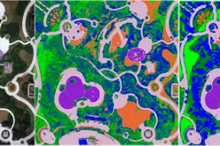
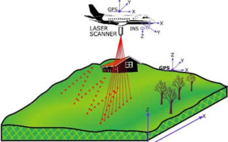
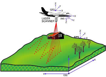
Jose Iriarte of the University of Exeter says that recent work has shown that the Amazon was populated with more complex societies than scientists had thought the forest could support. Dark earth, cultivated by humans to create raised agricultural fields, and geoglyphs made up of large ditches, can be spotted from the air by drones carrying Lidar technology, which uses lasers to map the topography of the ground.
“We are hoping that with Lidar we are going to be able to discover all of these archaeological features like mounts, ditches, trail ways and so forth, so that when you put them together you can really have an idea of the regional archaeological landscape,” Iriarte told Deutsche Welle.
The data will also help scientists see how humans have changed the forest. “This has implications for conservation because maybe the very biodiversity that we want to preserve today is not only the result of millions of years of natural processes, but also have a human footprint,” he said.