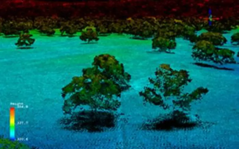
Credit: NEON
In a recent announcement by NEON, NEON Airborne Observation Platform (AOP) sample data is now available on the Airborne Data page.
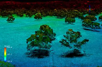
The NEON Airborne Observation Platform (AOP) is an aircraft platform carrying remote sensing instrumentation designed to achieve sub-meter to meter scale ground resolution, bridging scales from organisms and individual stands of vegetation to satellite-based remote sensing. These sensors include a Hyperspectral Imaging Spectrometer, a LiDAR system and a High Resolution Red Blue Green (RGB) camera. Key measurements are derived from these instruments yielding high level data products, such as: Vegetation Leaf Area Index, Total biomass, Vegetation indices, Ecosystem structure, Canopy biogeochemistry, Land Cover, Ground Elevation and Digital Surface Model.
This release contains full waveform LiDAR data, which is unique, cutting edge and free to download. A LiDAR system uses laser light energy to measure the heights of objects on the ground. Data from a LiDAR system may be used to estimate vegetation height, density and species composition. It also maps buildings, power lines and other infrastructure.