
Archive

PhD in Integrated Remote Sensing and Numerical Forecasting at CIRFA
The “Centre for Integrated Remote Sensing and Forecasting for Arctic Operations (CIRFA)” will contribute with research on methods and technologies that can reliably detect, monitor, integrate and interpret multi-sensor data describing

FUTA Students Launch the Nigeria Open Data Access (NODA) Portal
Three students from the Federal University of Technology Akure (FUTA) have launched the Nigeria Open Data Access (NODA) portal. The Nigerian open data access is one of the few open data

Earthserver Project Goes Into the Second Round
The EarthServer initiative is establishing Agile Analytics on Petabyte data cubes as a commodity Pushing the boundaries of Big Earth Data services, the intercontinental Earthserver initiative enables researchers to browse,
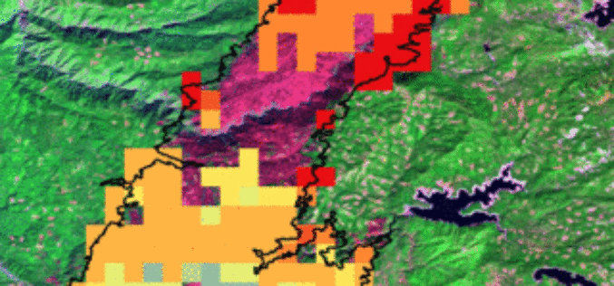
Battling Wildfires from Space: NASA Adds to Firefighters’ Toolkit
U.S. firefighters battling wildfires this year will get a clearer view of these threats with new NASA-funded satellite-based tools to better detect fires nationwide and predict their behavior. The new
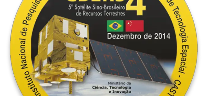
CBERS 4, Remote Sensing Satellite Jointly Developed by Brazil and China
CBERS 4, developed by the China Academy of Space Technology and Brazil’s National Institute for Space Research, the CBERS 4 was sent into Sun-synchronous orbit by a Long March 4B

The ArcGIS Book: 10 Big Ideas about Applying Geography to Your World
Learn to Make GIS Web Maps, Work with Mobile Apps, and Do More, Using The ArcGIS Book from Esri People around the world are discovering that online maps do more
Get the Latest version 10.2.6 of the ArcGIS Runtime SDK for .NET
Esri has announced the release of latest version 10.2.6 of the ArcGIS Runtime SDK for .NET. The allows to integrate ArcGIS functionality into Windows apps for desktop and mobile. SDK also
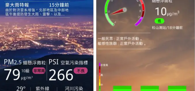
Real-Time Environment Info App – Connecting Smart Tech with GIS
Environmental Protection Administration, Taiwan has offered citizens and governmental sectors a comprehensive information portal since 2000, to meet the global concerns of environments. The portal provides visitors with various real-time
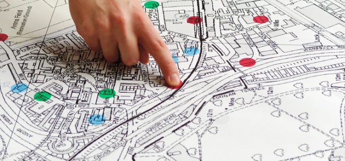
Property Sale Linking with GIS Maps
According to recent news by DNA, Maharashtra government is planning to link property sale with GIS Maps to make the system of computing ready reckoner rates more scientific and rational.

Trimble joins LASzip sponsors USACE, NOAA, and Quantum Spatial
July 13, 2015-Gilching, Germany – We are happy to announce that Trimble’s Geospatial Division has become a sponsor of the LASzip compressor. Their contribution as a Bronze sponsor will improve the existing
