
Archive

New Maps for Texas and Oklahoma Released
Updated US Topo maps for Texas and Oklahoma available for download; add Census Bureau road data, wetlands layer and select trails New US Topo maps for Texas and Oklahoma are

Vricon and Japan Space Imaging Partner on Bringing High-res 3D and Elevation Geodata Products to Japan
McLean, VA – 6 April 2016 —Vricon has announced it has selected Japan Space Imaging Corporation (JSI) for an exclusive reselling agreement. JSI is appointed as Vricon’s distributor in Japan
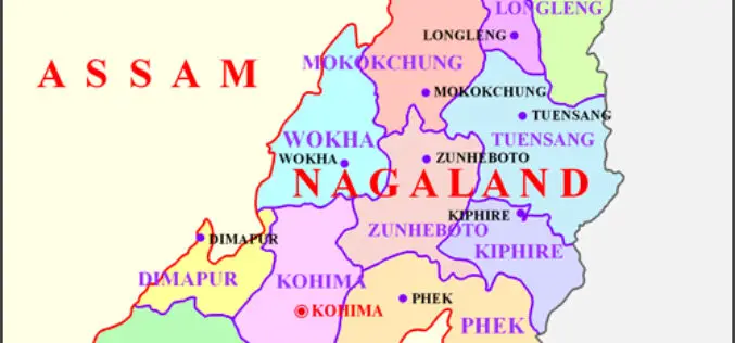
Space Technology Application Necessity in Nagaland
Nagaland’s Parliamentary Secretary Planning & Coordination, Evaluation and Taxes, Neiba Kronu today said that space technology application has become a necessity. The accuracy of all forms of data collected for

Leica Geosystems Smart Antenna Provides Superior Performance
Static, long term projects requiring a high number of sensors now have a new affordable smart antenna. This same device can also enable dynamic monitoring with up to 10 Hz data
Satellite Mapping for Property Tax Recovery
According to recent news by ToI, Navi Mumbai Municipal Corporation (NMMC) property department may levy property taxes which will also account for the alterations done from this year. The department

Pratt Institute Announces the Spatial Analysis and Visualization Initiative
On April 28, Pratt Institute will celebrate the official opening of the Spatial Analysis and Visualization Initiative (SAVI), the Institute’s research lab and service center focused on Geographic Information Systems

Trimble Launches New Version of its Smart Water Management Software to Streamline Utility Field Operations
Trimble Unity 3.0 Adds New Features to Ease Deployment and Connect Mobile Workers to Maps and Data SUNNYVALE, Calif., April 5, 2016—Trimble (NASDAQ: TRMB) announced today the latest version of

Esri Webinar: Eyes on the World
Eyes on the World Wed, Apr 20, 2016 | 1:30 AM – 2:30 AM IST Wed, Apr 20, 2016 | 6:30 AM – 7:30 AM IST Drones, UASs, and UAVs

NCTech Unveils New 360 degree Imaging Developments for iSTAR Camera
Company announces new measurement capabilities and colorization integration for FARO laser scanners Edinburgh, UK and Houston, TX – April 5, 2016 – NCTech, the developer of reality imaging systems, today

Tell Your Story Through Esri Story Maps and Win Prizes!
Would you like to be in sunny San Diego this June? Esri Story Maps let you combine authoritative maps with narrative text, images, and multimedia content. They make it easy
