
Archive
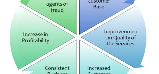
GIS in Banking
Contributed By – Banking/ Financial Services Banking and Financial Services are the utmost industries looking out for a safe and secure network. There is an imperative requirement to standardize the industry

Orbit GT Launches New UAS Mapping Software at SPAR
April 11, 2016 – Orbit GT will be launching new UAS Mapping software at the upcoming SPAR event in Houston, USA. “We’re very pleased to announce that our UAS Mapping
Cartosat-2C to Boost Military Surveillance
According to recent news by The Indian Express, ISRO’s earth observation satellite Cartosat-2C will be launched in May using a PSLV rocket. It will prove to be a shot-in-the-arm for India’s
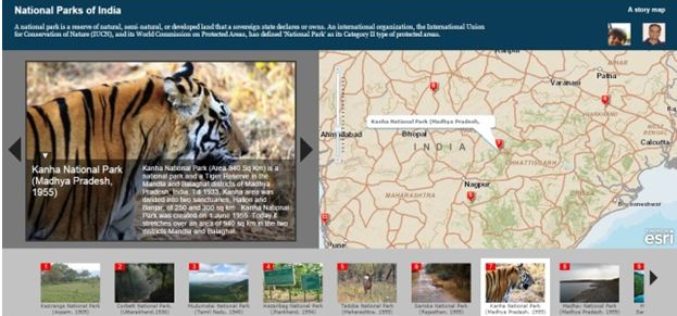
Story Maps by Esri Inc
Contributed By – What Kind of Story Do You Want to Tell? A. Sequential, Place-based Narratives 1. Story Map Tour℠ This app presents a sequential, place-based

Webinar:- Innovations in Geocoding 2016: Weave location into the very fabric of your data to gain new efficiencies and insight
Event Information: Innovations in Geocoding 2016: Weave location into the very fabric of your data to gain new efficiencies and insight Tuesday, April 26, 2016 2:00 pm Eastern Daylight Time
IISC Bangalore is Developing 3D Terrain Maps to Forecast Floods
According to recent news by the Bangalore Mirror, scientists from the city-based Indian Institute of Science (IISc) are developing high-resolution 3D terrain maps by using geographic information systems (GIS) to visualise
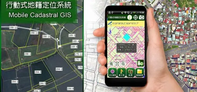
Smart Mobile Solution for Cadastral Mapping, Time to Go International!
It’s time to announce the next huge leap of SuperGIS Mobile Solution! The well-known Mobile Cadastral App powered by Supergeo, one of the best-selling land management and cadastral survey work

Esri Webinar: Drone2Map for Engineering and Construction
Drone2Map for Engineering and Construction Tue, Apr 26, 2016 11:30 PM – Wed, Apr 27, 2016 12:30 AM IST Unmanned aerial systems enable engineers to better understand the terrain they
ISRO to Monitor Water Bodies in Tribal Areas Using Geospatial Technology
New Delhi – In a first, ISRO’s National Remote Sensing Centre (NRSC) will monitor and map the water bodies in tribal belts in the country to help tackle irrigation crisis

Second Belarusian Remote Sensing Satellite in Orbit in 2019
MINSK, 7 April (BelTA) – The Belarusian satellite BKA-2 is supposed to be inserted into an orbit around the Earth in 2019, BelTA learned from Sergei Zolotoi, Chief Designer of
