
Archive
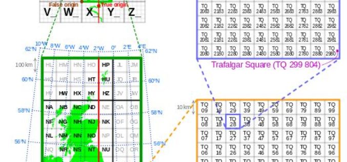
Is Britain on the move?
Australia has recently announced a 1.8m shift in its mapping coordinates, to compensate for the country’s 7.5cm shift north each year. Inevitably the question is why, and could the same

Esri and Leica Partner to Offer Grants to Governments
Smart Communities Innovation Challenge Provides Support for Improving Mobile Government Redlands, California—Geographic information system (GIS) provider Esri has partnered with Swiss-based spatial measurement instrument manufacturer Leica Geosystems to encourage innovation

Conducting a More Precise Fieldwork
Receiving high accuracy data is the ultimate goal of fieldworkers and surveyors. Now, two core products of SuperGIS Mobile Series: SuperSurv for Android and SuperPad are all capable of receiving

Trimble Acquires AXIO-NET GmbH – Recognized Provider of GNSS Services
Trimble Reinforces its Presence in Europe as a Leader in GNSS Correction Services SUNNYVALE, Calif., Aug. 1, 2016—Trimble (NASDAQ: TRMB) announced today the acquisition of AXIO-NET GmbH from Airbus Defence
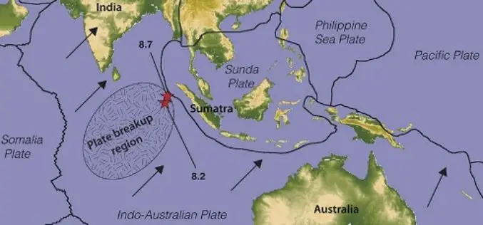
Australia’s Coordinates out by More Than 1.5 m
The Australian continent tectonic plate is moving 7 cm a year (and colliding with the Pacific Plate, which is heading west 11 cm a year) and experts at Geoscience Australia
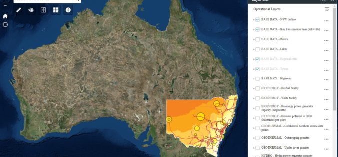
New South Wales Government Launches Renewable Energy Resources Map
In a recent news release by the New South Wales Government, in a state first, NSW will have a renewal energy map to help drive investment in new renewable projects across
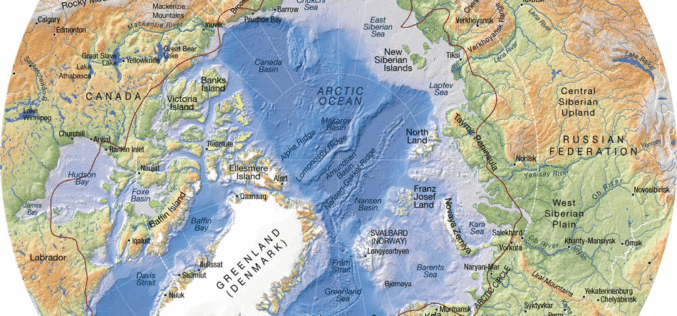
Federal Agency for Geodesy and Cartography Commissioned New Project to Compile New Arctic Atlas
The Federal Agency for Geodesy and Cartography commissioned a project to compile and publish a national atlas of the Russian Arctic, according to a RIA Novosti report. The entire project was estimated at 80 million
