
Archive

Odisha Government Includes 7 Kharif Crops Under PMFBY Insurance
According to recent news by the Outlook, Odisha government has recently decided to include seven major crops – paddy, groundnut, cotton, turmeric, ginger, red-gram (arhar) and maize – under the
Airbus Creates New Commercial Drone Services Start-up “Airbus Aerial”
– Launches U.S. base and business, headquartered in Atlanta, Georgia – Starts operations with imagery services fusing drones, satellite images, and software to bring deeper insights to commercial customers –

Global Mapper Mobile Now Available for Android Devices
Blue Marble Geographics is pleased to announce the immediate availability of a beta release of the Android version of its Global Mapper Mobile app. Mirroring the capabilities of the iOS

PCI Geomatics Now a Planet Ecosystem Partner
MARKHAM, Ontario, Canada, May 9, 2017 — PCI Geomatics, a world-leading developer of remote sensing and photogrammetric software and systems, announced today it has become a Planet Ecosystem Partner. PCI
World’s Largest Satellite Fleet Owner Joins The Geological Remote Sensing Group
The Geological Remote Sensing Group (GRSG) has expanded its membership once again with the recent news that Planet; the owners and operators of the world’s largest commercially-operated fleet of satellites
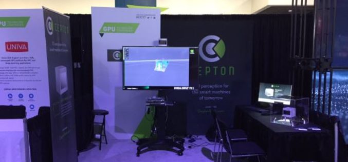
Cepton Launches its High-Performance LiDAR Solutions
Next-generation optical sensors deliver perception to smart machines with unrivaled resolution and cost May 09, 2017 – SAN JOSE, Calif.–(BUSINESS WIRE)–Cepton Technologies, Inc., a provider of 3D sensing solutions for automotive
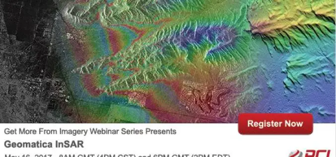
PCI Geomatics Webinar Series: Geomatica InSAR
PCI Geomatics Webinar: Geomatica Object Analyst May 16, 2017 | 8AM GMT / 4PM CST & 6PM GMT / 2PM EDT In this webinar, we’ll take a deep dive into the new InSAR
CARTO Delivers Most Advanced Offline Maps with New Mobile SDK for Android & IoS
Users can develop custom mobile apps with native offline mapping, location data services, and the analytical power of location intelligence New York, New York – May 09, 2017 – CARTO, the

OGC invites you to its Environmental Linked Feature Interoperability Experiment: ELFIE
Monday, 8 May 2017 UTC – The Open Geospatial Consortium (OGC®) invites interested members & non-members alike to participate in the OGC Environmental Linked Feature Interoperability Experiment (ELFIE). In recent years,

PrecisionHawk Launches Free PrecisionMapper Software for Drone Mapping
Now drone operators can stitch an unlimited number of photos, create maps without resolution limits and run algorithms to analyze their data for free PrecisionHawk, a leading commercial drone and
