
Archive
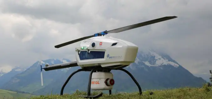
Swiss-based UAV Pioneer Aeroscout Introduced Their New Scout B-330 UAV Helicopter to the North American Market
Swiss-based UAV pioneer Aeroscout introduced their NEW Scout B-330 UAV Helicopter to the North American Market at this year’s AUVSI XPONENTIAL in Dallas, Texas! Aeroscout, a long-term partner of performance
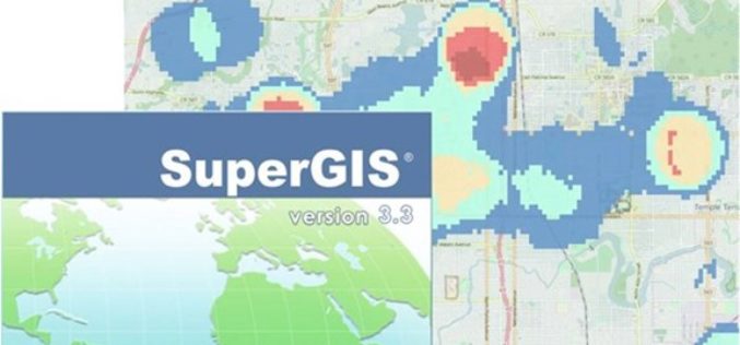
Supergeo Releases the Latest Update of SuperGIS Desktop 3.3
Developed by one of worldwide leading providers in GIS software- Supergeo, SuperGIS Desktop is a practical, multifunctional, and affordable GIS solution designed for professionals in various industries such as urban

Open Data: Engine for Innovation or Simply Hot Air?
Open Data: Engine for Innovation or Simply Hot Air? Karlsruhe/Berlin, 25 May 2017 | The INTERGEO conference will be hosting what promises to be an exceptionally transparent panel discussion between

SuperGIS Manuals Are Now Available Online!
No matter you are a GIS beginner or an old hand; we always have some moments that are uncertain about how to use a particular function, like how to create

Enjoying the High-Accuracy Positioning with the Latest SuperPad 10
The first stable version of SuperPad 10 has been released for over one and a half months. In the first release, SuperPad 10 not only already equips with numerous practical

GHGSat Unveils Satellite Imagery of Greenhouse Gas from Industrial Facility
On May 23, 2017, GHGSat Inc. unveiled sample imagery from its demonstration satellite, Claire (or GHGSat-D), which has detected emissions of methane from a hydroelectric facility under construction in Africa.
TerraGo Webinar: How to Build Custom Cloud-Based, Enterprise Mobile Apps with Clicks Not Code
TerraGo Webinar: How to Build Custom Cloud-Based, Enterprise Mobile Apps with Clicks Not Code June 6, 2017 | 12:00 PM (ET) TerraGo Magic enables any organization to rapidly transform their

At Least 15 Russian Remote Sensing Satellites to Operate by 2020
Russian President Vladimir Putin stated that the remote sensing technologies must be used to boost the Russian defense and security, develop the economy and social sphere, and increase the quality
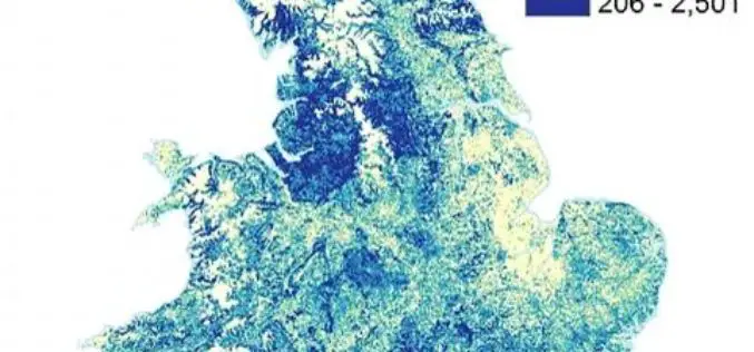
Bluesky Tree Map of Britain Used to Create First High Res Maps of Allergenic Pollen-Producing Plants
A map of over 280 million trees nationwide has been used to create the first high resolution maps of allergenic plants and trees of Great Britain. Detailing the location of
MDA to provide US National Oceanic and Atmospheric Administration (NOAA) with RADARSAT-2 Information for Ice Monitoring
Vancouver, BC – MacDonald, Dettwiler and Associates Ltd. (“MDA” or the “Company”) (TSX: MDA), a global communications and information company, today announced that it has signed a contract with the
