
Archive

Icaros and TeAx Announce an Integrated Drone Mapping Solution for Radiometric ThermalCapture (FLIR core) Sensors
FAIRFAX, Virginia, USA / WILNSDORF, Germany, 26 July 2017 – Icaros Inc., a leading provider of aerial imaging software, is pleased to announce that version 5.1 of OneButton™ Standard and Professional

MicaSense Atlas is Now Integrated with Pix4D Desktop Software
This partnership is designed to offer MicaSense customers the power of desktop processing, as well as the flexibility of MicaSense Atlas. “Our customers value Atlas as an analytics and collaboration
USACE Mobile District Signs WMR-532 to $46M Coastal Mapping Contract
WMR-532, the joint venture of Woolpert and Optimal Geo, will provide bathymetric and topographic lidar and imagery in support of JALBTCX task orders around the world. DECATUR, Ala. (July 26,

OGC is Calling for Sponsors for an Innovative Interoperability Initiative, Testbed 14
Thursday, 27 July 2017 – The Open Geospatial Consortium (OGC®) has issued a call for sponsors for an innovative interoperability initiative, Testbed 14. The OGC Innovation Program provides a venue

Trimble Introduces New Android Application for Field Surveying and Data Collection
Easy-to-Use Trimble Penmap for Android Simplifies Field Work SUNNYVALE, Calif., July 26, 2017—Trimble (NASDAQ: TRMB) introduced today Trimble® Penmap® for Android™, a cloud-connected application for field surveying and high-accuracy Geographic
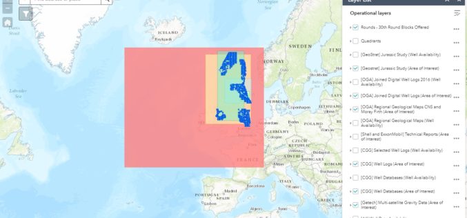
OGA Makes Another Set of Data Packages Openly Available for Oil and Gas Explorers
The Oil and Gas Authority (OGA) is continuing to make more and more data openly available in an effort to help revitalise exploration of oil and gas in the UK
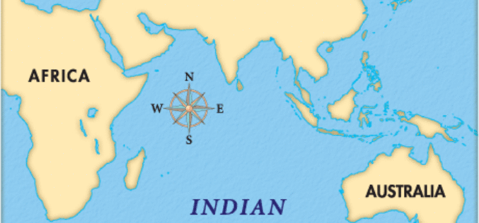
Indian Ocean Level Rising Faster Than Compared to the Global Estimate
IANS – New Delhi: Global warming is leading to an accelerated rise of the sea level in the north Indian Ocean as compared to the global estimate, Parliament was informed on

CNH Industrial and Trimble Announce Data Sharing Connectivity
Integration Enables Farmers to Access their CNH Task Data within the Trimble Ag Software Solution ST. LOUIS, Mo., July 25, 2017—Trimble (NASDAQ: TRMB) and CNH Industrial (NYSE: CNHI / MI:

INTERGEO – Bridge to a Digital Future
Karlsruhe/Berlin, 24, July 2017 | When Geo IT experts from the worlds of business and science sat down together at a roundtable for INTERGEO and got talking, they put together

Esri Story Map: Unusual Indian Weddings that Challenged Stereotypes
Contributed By:- Here are the wedding stories of young couples and their families who dared to fight stigmas and break stereotypes. These stories rekindle faith in humanity and leave you
