
Archive

Usage of 3D Geospatial Data in Smart City
After COVID-19 across the globe, governments are ready to invest in smart city expansion in all possible locations of each geography. The productive outcome of economic development will be reached

Geospatial Imagery Analytics Market revenue to hit US$50 Bn by 2032
As per a recent industry report put forward by Global Market Insights, Inc. Geospatial Imagery Analytics Market is forecast to register its name in the billion-dollar fraternity down the line

Lemur Mobile GIS Solution from Locana Now an SAP® Endorsed App as Part of SAP’s Industry Cloud Portfolio
Lemur Adds Geospatial Capabilities to SAP Service and Asset Manager Mobile App Locana, an international leader in spatial technology, announced that SAP has premium certified Locana’s Lemur mobile GIS solution as an SAP Endorsed App. It is available on SAP® Store as part
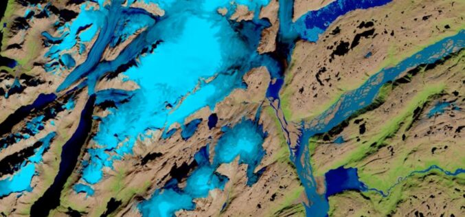
The Impact of Climate Change is Being Researched using AI by IBM and NASA
IBM and NASA’s Marshall Space Flight Center have recently announced a partnership to employ IBM’s artificial intelligence (AI) technology to unearth new insights in NASA’s huge repository of Earth and
