
Archive
TOPODRONE – RASA Surveying Partnership Augments Coastal Mapping, Serves Resilient Communities
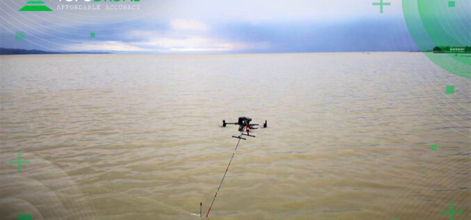
TOPODRONE, a Swiss based designer and manufacturer of high-precision surveying equipment, and RASA Surveying, an integrated surveying company, enter a technological partnership to advance airborne surveying approaches and accommodate coastal

China Successfully Launched Yaogan 34-04 Remote Sensing Satellite
China has once again demonstrated its growing capabilities in space technology, as it successfully launched a remote-sensing satellite on Friday (March 31, 2023). The satellite, named Yaogan 34-04, was launched
RMSI Recognized as an Esri Cornerstone Partner for 20 Years of Commitment to Esri and ArcGIS Technology
RMSI was recently recognized as a Cornerstone Partner at the 2023 Esri Partner Conference (EPC) held in Palm Springs, California, March 4–6, 2023. This acknowledgment was presented to RMSI for
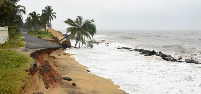
Odisha Coastlines Loses Its Shine Due To Past 10 Cyclones in 12 Years
Sea erosion has been witnessed along the Odisha coastlines due to frequent topical cyclones and floods. The intensity of devastation is witnessed in six coastal districts Balasore, Bhadrak, Ganjam, Jagatsinghpur,
