
The WorldDEM™ from Astrium is Intended to be the Replacement Data Set for SRTM
Here it comes the most accurate DEM after a long overdue treat. The WorldDEM™ data from Astrium is a global elevation dataset of unprecedented quality, accuracy, and coverage from two the two German satellite missions, TerraSAR-X and TanDEM-X are carried out as a Public Private Partnership (PPP) between the German Aerospace Centre (DLR) and Europe’s leading space company, Astrium. Astrium GEO-Information Services holds the exclusive commercial marketing rights and is responsible for the adaptation of the elevation model to the needs of the commercial users and for its world-wide marketing.
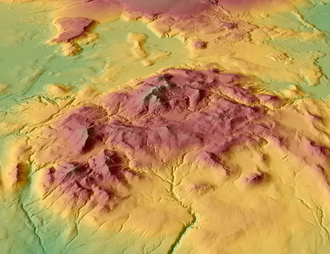
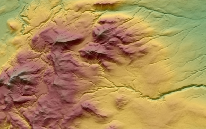
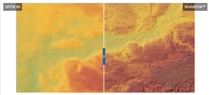
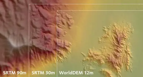
The WorldDEM™ is a global elevation dataset of unprecedented quality, accuracy, and coverage and will be available from 2014 for the Earth’s entire land surface – pole to pole. The accuracy of the WorldDEM™ will surpass that of any satellite-based global elevation model available today.
The WorldDEM™ is intended to be the replacement data set for SRTM and will have the following unique feature:
- Vertical accuracy: 2m (relative) / 10m (absolute)
- 12m x 12m raster
- Global homogeneity
- Highly consistent dataset thanks to data collection within 2.5 years only
- High geometric precision of the sensors make ground control information redundant
Numerous Applications Benefiting from this New Product
The WorldDEM™ will support:
- High-quality image orthorectification
- Increased precision of height information within standard cartographic maps and map updates
- More targeted preparation of defence and security missions
- Enhanced international cooperation and cross-border mission planning
- Improved crisis intervention planning and emergency response support
- Management of oil and gas fields
TerraSAR-X and TanDEM-X acquire data absolutely reliably, as they operate independent of cloud coverage and lighting conditions. The worldwide homogeneous acquisition guarantees a global DEM with no break lines at regional or national borders and no heterogeneities caused by differing measurement procedures or data collection campaigns staggered in time.
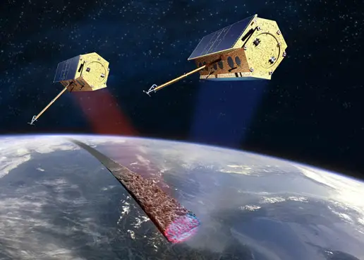
TerraSAR-X and TanDEM-X started the synchronous data acquisition in December 2010 and completed the first coverage of the Earth’s entire landmass within only 13 months. Following the first part of the acquisition campaign, the two satellites are continuing with the second coverage, which again requires approximately one year for completion. More complex terrain areas are covered with a third and fourth acquisition campaign to ensure the consistently high quality and accuracy of the final product.
Related Topic
Difference Between DEM, DTM and DSM
WorldDEM™ Brochure
Experience the Quality and Accuracy of the WorldDEM™


Is it available for free download or it is still under process
Dr. Hussein Gamal,
As per the information provided on the Astrium website (http://www.astrium-geo.com/) you need to order the data from GeoStore (http://www.astrium-geo.com/geostore/).
Ok, I See.
Thanks for your efforts